ZETICA
Engineering Services
FromZETICA
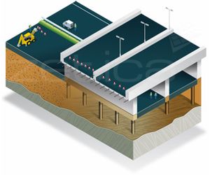
Proving ground to be competent for planned engineering uses can help to prevent subsequent, dramatic remedial measures. Zetica provides rapid non-invasive surface and borehole geophysical methods to characterise materials and detect unpredictable features before these become costly, time-consuming problems.
Most popular related searches
bedrock mapping
geophysics method
brownfield site
borehole geophysics
groundwater mapping
bedrock
surface groundwater flow
groundwater flow path
borehole method
hazardous site
- Locate voids and sinkholes
- Locate mineshafts and adits
- Map bedrock depths
- Map bedrock rippability
- Map fractures and identify weak zones in bedrock
- Locate shallow sand and gravel deposits
- Map groundwater surface and flow paths
- Determine unknown depth of foundations
- Evaluate structures – bridges, weirs
- Evaluate pavement - roads, runways
- Detect buried hazards on brownfield sites