Geo2X SA
Environment & Risks Services
FromGeo2X SA
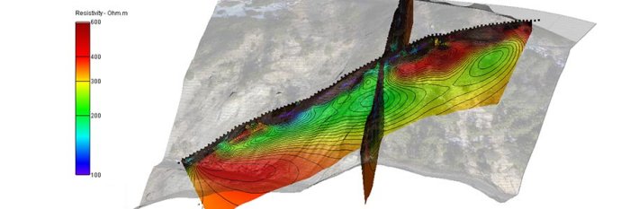
The subsurface imaging capacity of geophysics is a key component of an geological or environmental site assessment. Buried waste, landslides, aquifers all have a specific signature and can be investigated by dedicated geophysical measurements.
Most popular related searches
environmental site assessment
decontamination work
subsurface imaging
site assessment
geophysics
waste contaminated soil
landslide
environmental assessment
geohazard
aquifer
- Buried waste or soil contamination are more and more often found. Accurate positioning by geophysics prior to excavation allows for a more secure decontamination work.
- Our equipment allows us to work in all environments, even in dense urban areas.
Risks
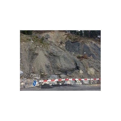
- Landslides and other geological hazards have a very strong impact on infrastructures. Geophysical profiles are perfectly suited to provide information about sliding planes, groundwater content or faulting.
- Other geohazard mitigations can benefit from geophysical measurements (cathodic protection, soil liquefaction, cavities, etc.). Each of these can be assessed by a specific type of geophysical acquisition.