

- Home
- Companies
- The Response Group
- Services
- Geographic Information System (GIS) ...
Geographic Information System (GIS) Mapping & Modeling
The functionality offered by Geographic Information System (GIS) technology and related software packages, allows for the enhancement and increased effectiveness of information presented in a mapping format. GIS mapping can improve any plan and provides an invaluable way to visually present information. The Response Group has more than 30 years combined experience preparing maps and GIS information displays.
We can provide your company with the following:
- Spill Modeling - Domestic & International
- Spill Trajectory Mapping
- Air Plume Modeling
- Emergency Response Mapping Support
- Overflight & Situation Display Maps
- Custom Mapping
- Offshore / Onshore Asset Maps
- Pipeline Rout Assessment Maps & Key Maps
- DOT High Consequence Area Assessment Maps
- Large Scale Wall Maps
- Onshore / Offshore Platform & Facility Fact Sheets
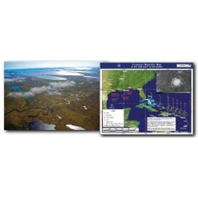
Spill Trajectory Modeling
Spill Modeling software allows for significant determination of product movement and identification of potential areas of impact. Trajectories can be developed quickly as part of an actual response or live exercise, or as part of an active preparedness and planning program. Knowing the direction of product movement, and time of arrival, provides the responders information that is critical to planning an effective response.
Air Plume Modeling
Air Plume Modeling determines how air pollutants travel and disperse in the atmosphere as a result of meteorological conditions. The model can predict the downwind concentration of an air plume from any chemical release that may be caused by such things as fires, gas leaks or explosions. This prediction also builds a hazardous zone footprint that can be added to a detailed map using GIS software. Such models are important to emergency responders tasked with protecting and managing areas surrounding the source.
Subsurface Trajectory Modeling
The spill modeling technicians at The Response Group™ have been trained on new approaches to subsurface spill forecasting in OilmapDeep and OSCAR. Already utilized in a handful of exercises, this new technology is quickly gaining support from industry partners and provides a new spill modeling technique.
- Geographic Coverage
- Domestic & International
- Application
- Pipeline Rupture
- Well Blowout
- Hydrate Formation Consideration
- Emergency Response Mapping Support
- Emergency Response
- Drill Design
- Exercise Support
Subsurface Trajectory Mapping
Subsurface modeling tracks the fate of oil below and above the surface, allowing us to determine the amount of time it takes for oil to reach the surface and at what location it will reach the surface. It also allows insight into the calculated differences between surface and subsurface currents.
Forecasted or historical winds and currents from around the world are integrated to generate models with low to high flow rates at any depth below the surface.