

J-U-B Engineers, Inc.
Geomatics/Surveying Services
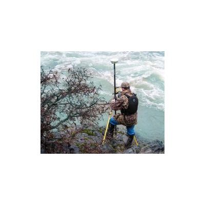
Our surveyors have literally been to Hells Canyon (Idaho) and back. From the rapids of the Snake River to the busiest intersection in Salt Lake City, J-U-B’s surveyors have renowned experience and expertise with cadastral and boundary surveys, littoral and riparian boundaries, three‑mile surveys, ALTA surveys, and topographic surveys. We use the latest technologies and equipment, keeping us at the forefront of quality and productivity.
Most popular related searches
robotic total station
LiDAR scanning
GNSS receiver
laser scanning
geodetic control
land development
GNSS
geomat
LiDAR
land surveying
Our staff has vast experience utilizing state‑of‑the‑art survey equipment and related software, including LiDAR scanners, robotic total stations, GNSS receivers, and digital levels.
Our surveying services include:
- 3-D Laser scanning
- American Land Title Association (ALTA) Surveys
- Boudary Surveys
- Cadastral Surveys
- Construction Staking
- Digital and Optical Leveling
- Easement and Boundary Descriptions
- Geodetic Control
- Legal Descriptions
- Parcel Descriptions
- Plat Review
- Platting
- Records of Survey
- Right-of-Way and Easement
- Survey Control for Aerial Mapping
- Topographic Control