
Utilities - Geophysical Solutions for All Site Conditions
Zetica services are flexible and adaptable to clients` project requirements. We offer several levels of service ranging from the straightforward marking out and identification of buried utilities to a comprehensive 3D mapping of above- and below-ground utilities. Zetica offers a complete utility surveying service backed by more than a decade of site experience and innovative technology research. As specialists in this field, we recognise that not all technologies work well on all sites. However, our suite of in-house, state-of-the-art detection equipment coupled with an in-depth understanding of site conditions, means that we can tailor our services to deliver optimum results every time.
- Property developers
- Consultants
- Contractors
- Airport authorities
- Local authorities
- House builders
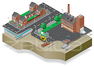
2D (top) and 3D (bottom) CAD drawings of interpreted utilities from a ground-penetrating radar survey.