

High Definition 3D Laser Scanning Survey for Land Service
State-of-the-Art: 3D Technology. Calvada Surveying is proud to be an elite land surveying firm offering the most state of the art in surveying technology called High-Definition Surveying (HDS), or 3D laser scanning. This powerful technology not only allows us to perform our traditional laser scanning services or surveying services more quickly and accurately, but also opens up new ways of providing value to our clients.
At the beginning of any renovation, retrofit, remodel, expansion or addition project, the management, construction and design team need access to accurate data of existing conditions (As-Built conditions). Team members can face a number of As-Built Documentation challenges including obsolete or total lack of As-Built Drawings, and manual collection of As-Built measurements can be slow and error-prone.
3D laser scanning survey or High-Definition Surveying is an innovative tool used by CALVADA that simply put, takes the guess work out of obtaining As-Built Documentation. HDS or 3D laser scanning survey provides an unobtrusive method to obtain highly accurate As-Built information of ANY indoor or outdoor man-made or natural structure quickly and efficiently, under any lighting conditions and regardless of site conditions, often in as little as a few hours
Our advanced 3D laser scanning systems utilize the accuracy and speed of lasers to precisely provide land features into a three dimensional model. The 3D model can then be inspected for defects, regardless of how complex the object`s shape, size or structure may be. Our latest and high-tech laser scanners are guaranteed to capture every metric. Applications for our laser scanning surveys range from inspection to prototyping.
The raw scanner data, or 3D point cloud, can be used with software to view, pan, zoom, and rotate in 3D and obtain instant point to point measurements from. Our 3D laser scanning services gives you more accurate and quick results. With additional post-processing and laser scanning services, the raw data can be translated into accurate 2D or 3D AutoCAD drawings to be utilized for 3D visual walk-throughs and 2D or 3D design, and can even be rendered further into a full 3D solid model.
The benefits of utilizing High-Definition Surveying or 3D laser scanning to obtain As-Built Drawings are:
- Provides more accurate and more detailed As-Built Drawings over information obtained from manual measurements and outdated or incomplete previous As-Built Drawings
- Accurate As-Built Drawings translate directly into reduced project costs through the reduction of construction reworks and construction delays
- Prevents schedule delays by reducing data collection time for obtaining As-Built information
- Safer data capture - all information can be captured safely from the ground without the need for safety harnesses
- Eliminates costly "return visits" to a project site
- Reduces facility downtime as a result of the unobtrusive data capture and reduced field construction time
- As-Built Surveys for exterior or interior building renovation, retrofit, remodel, expansion, or addition
- As-Built Surveys of complex facilities such as processing plants
- Piping and Ductwork Retrofits
- Building Information Modeling (BIM)
- Historic Building Preservation & Renovation
- Façade laser Scanning for Historic Restoration
- Freeway / Highway Design Surveys
- Bridge / Tunnel Design Surveys
- Surveying of busy street intersections - eliminates need for traffic control
- Construction Volume Calculations
- 3D Modeling
- 3D Topographic Surveys
- Monitoring Structure Deformation
- Surveys for Hazardous Site Areas
- Forensic Surveys (accident/crime scene reconstruction)
- Marketing Tool - allows your client to view area in 3D without having to be there
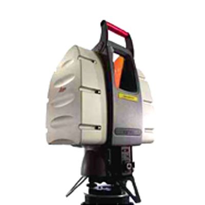
The High-Definition Surveying or 3D laser scanning survey system is a high-speed, high-accuracy laser radar scanner with a 360° x 270° field of view. The laser technology can scan any interior or exterior man-made or natural structure or area within its field of view and create a complete raw data set in the form of a 3D image made up of millions of points of data, called a "3D point cloud". Every two points of the 3D point cloud provide direct point to point measurements within AutoCAD to within 6 mm accuracy! Quick, complete surface geometry is safely and accurately captured with the High-Definition Surveying or 3D laser scanning surveys system.
The raw scanner data, or 3D point cloud, can be used with software to view, pan, zoom, and rotate in 3D and obtain instant point to point measurements from. With additional post-processing and laser scanning services, the raw data can be translated into accurate 2D or 3D AutoCAD drawings to be utilized for 3D visual walk-throughs and 2D or 3D design, and can even be rendered further into a full 3D solid model.