
Earth Scan Technologies Ltd.
Earth Scan - LiDAR Service
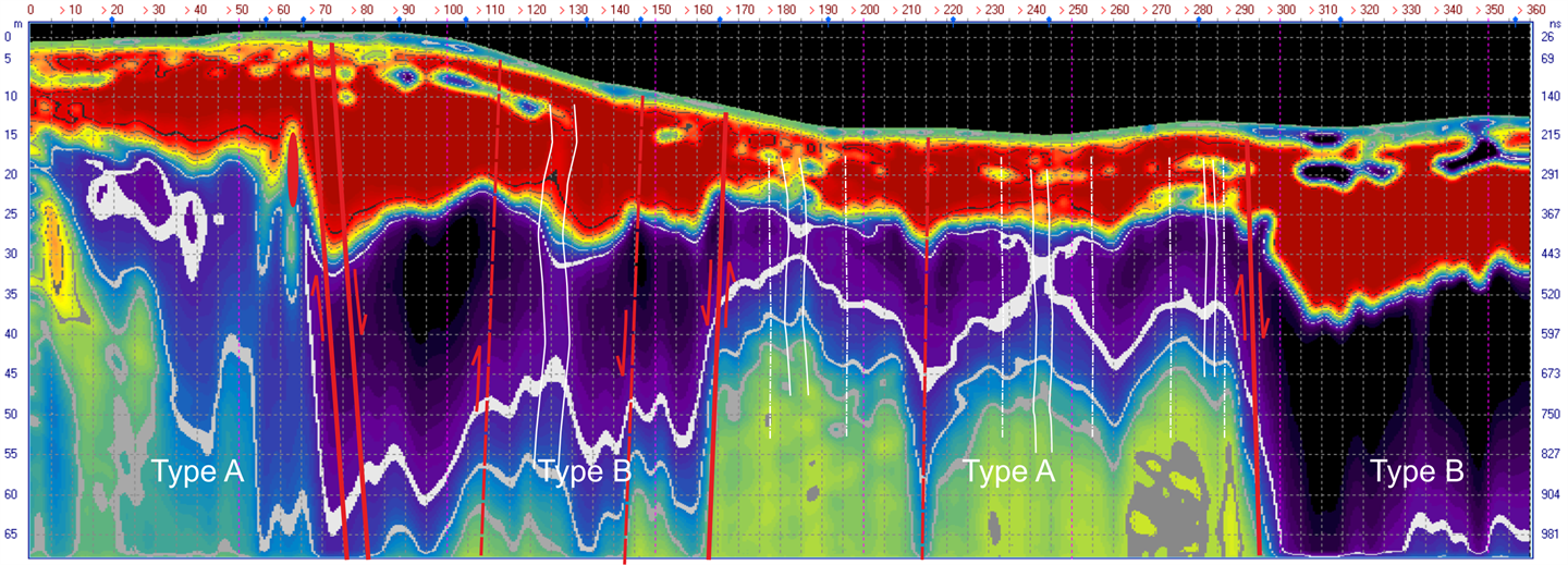
LiDAR is a very effective tool for creating 3D representations of a target area, including underground in confined areas such as old mine shafts. Earth Scan has partners with the leading technologies and can be deployed by UAV or fixed wing aircraft.
Most popular related searches
Applications include:
- Volume calculation
- Geology monitoring
- Soil profiling
- Confined area mapping