
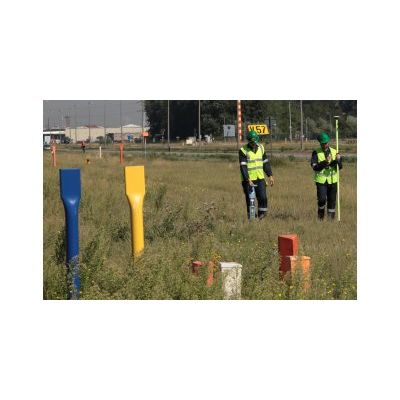
Pipeline localization and digitalization
GIS
GPS measurements enable the easy import and digitalisation of the structure at a very limited additional cost in any Geographic Information System (GIS) of CAD drawing.
Up-to-date
Whereas plans only represent the position of your underground infrastructure as it was in the past, our measurement method delivers the latest information to keep your infrastructure database up-to-date. This is very important in our fast-changing environment.
Third party interference control
Knowing the exact current location of the underground structures is a very crucial item for an optimal third party interference control.
Depth of cover
Our localisation and digitalisation program enables us to determine the depth of underground pipelines & cables. We evaluate them according to the (legal) standards without having to excavate. Insufficient depth is more likely to cause accidents, especially with low cover ditches and canals that are being cleaned every year.
Highly advanced software
We can proudly announce that the software tool "PERSEUS", which we developed ourselves, is our secret weapon. It is a flexible application to collect, analyse and report your pipeline data. As such, we clearly map your complete pipeline infrastructure. With our management module we allow you to filter and visualise the valuable data.