
- Home
- Companies
- Herzog Technologies Inc.
- Services
- PTC Data Collection & Management ...
PTC Data Collection & Management Service
Accurate, reliable surveys. Without service interruption. Collection: We have the capability to do GIS surveys and gather the data necessary to keep PTC running. Our services are, at their core, specifically designed for the rail industry. We can capture any PTC features you may need.
Customized Data Processing
After completing the surveys and processing the data, we deliver the data to our customers in the PTC Data Model format, establishing compliance with standard data models. If you need additional information from the survey, we can customize the management and delivery to fit those needs.
Data Management
Not only does Herzog conduct surveys and gather PTC GIS data, we also have the ability to handle data management. We provide feature extraction, data archiving, and validation: everything necessary to run your PTC system.
Our data management process begins with archiving the original data from the surveys. We then move on to location extraction, identifying features and track segments. In addition, we incorporate railroad data such as speed limits and operating rules. We validate all information and ensure interoperability, maintaining version control and data model compliance throughout the entire process.
SpeedTrax
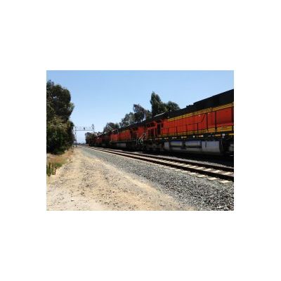
PTC GIS surveys can require a large amount of valuable track time. Herzog’s solution is SpeedTrax, which surveys the right-of-way at track speed. The data includes accurate position information for all PTC critical features. SpeedTrax is non-invasive and low maintenance, allowing your railroad to continue its daily operations and simultaneously conduct surveys.
SpeedTrax
PTC GIS surveys can require a large amount of valuable track time. Herzog’s solution is SpeedTrax, which surveys the right-of-way at track speed. The data includes accurate position information for all PTC critical features. SpeedTrax is non-invasive and low maintenance, allowing your railroad to continue its daily operations and simultaneously conduct surveys.
Delivery
Track charts, which display speed, signaling, grade, curve, and any data required for PTC, are automatically generated from your GIS data. In addition to the track charts, we create the necessary data files for supporting PTC operation, crew training simulators, and radio planning and management software.