

Spatial Planning Services
Our experience with natural resource data, traditional and alternative energy issues, and spatial analytic techniques makes us uniquely suited to help our clients with: Marine Spatial Planning. Sea Level Rise, Climate Change and Coastal Flooding. Quantitative Risk Evaluation. Route and Site Selection.q
- Offshore Alternative Energy:
Worldwide Synthesis and Analysis of Existing Information Regarding Environmental Effects of Alternative Energy Uses on the Outer Continental Shelf
- Coastal Geomorphology:
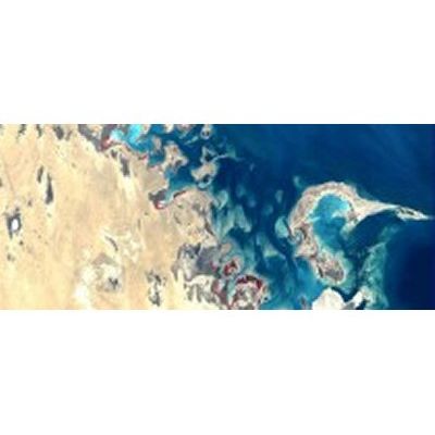
Coastal geomorphology has been a foundation science for RPI since its inception. Today, coastal geomorphological principles are being applied to beach erosion projects around the world, ESI mapping projects, developing inlet protection strategies, and other projects. We specialize in rapid assessment of large coastal areas, as exemplified by our surveys of the coastlines of Oman, Israel, and Saudi Arabia. (See our Coastal Geomorphology publications)
- Environmental Assessment and Environmental Impact Statements:
Most government and funding agencies that sponsor major engineering projects require that an assessment of the potential environmental impacts of the project be carried out. RPI specializes in assessment of large-scale projects in the coastal zone.
- Abandoned/Submerged Vessels and Groundings:
We have been assisting the National Oceanic and Atmospheric Administration to evaluate the risks to coral reefs, seagrass, and mangroves posed by abandoned vessels in tropical regions of the U.S.
- Environmental Sensitivity Index (ESI) Mapping of Coastal Habitats and Resources:
We have mapped the shoreline habitats and biological resources of most of the shoreline of the USA, as well as several international areas. This database, which is in a digital, GIS format, allows us to predict the potential impacts of hazards such as oil spills, sea level rise, and storm surges.
- Reach Sensitivity Index (RSI):
RPI developed the RSI classification of small rivers for oil spill contingency plans in inland areas. Responders need to be able to quickly identify the sensitivity of specific stretches, or reaches, of streams. The streams of the southeastern U.S. were analyzed for reach sensitivity and the resulting RSI scale was implemented on the Leaf River in southern Mississippi and the entire inland area of Puerto Rico.
- Water Resource Analysis, Modeling, and Management:
Because of our broad experience in wetland science and ecology, riverine morphology and sedimentation, GIS, spatial modeling, land use forecasting, hazardous material spills, and other related areas, RPI is uniquely qualified to conduct water resource analysis, modeling, and management.
- Pipeline and Facility Response Plans:
RPI created Unusually Sensitive Areas (USAs) for both ecological and drinking water resources for all 50 states, to support the Office of Pipeline Safety regulations for Pipeline Integrity Management Systems. In addition, RPI has developed specific Pipeline Integrity and Facility Management programs to assist clients in identifying pipeline segments and facilities that have the potential of affecting High Consequence Areas (HCAs).
Aquaculture and Fisheries: The development of aquaculture projects must be conducted in an environmentally responsible manner. This is particularly evident in coastal zones, where, in the past, mangroves and other critical habitats were adversely affected, or even destroyed, by poorly planned projects.
A profound understanding of physical coastal processes and biological systems, combined with extensive experience in environmental monitoring, makes RPI unique in our ability to develop environmentally sound aquaculture projects.