

CPH Engineers, Inc.
- Home
- Companies
- CPH Engineers, Inc.
- Services
- Survey & Mapping Services
Survey & Mapping Services
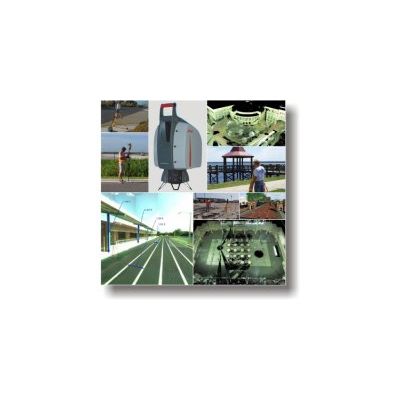
CPH, a premier provider of surveying and mapping services, is setting the standard in the surveying and mapping industry. CPH`s surveying and mapping professionals include registered professional surveyors, survey technicians and survey field crews, all of whom are focused on providing quality surveying and mapping services.
Most popular related searches
mapping service
geographic information system
geographic information
property transaction
land surveying
wetlands mapping
wetlands
infrastructure mapping
CPH utilizes sophisticated, state-of-the-art equipment and technology, such as GPS (global positioning system) and GIS (geographic information system), traditional total station surveying methods, the latest computer aided design software as well as High-Definition Laser Surveying, with a Leica ScanStation 2 Laser Scanner.
CPH`s Surveying & Mapping Services Include:
- ALTA/ACSM Land Title Surveys
- Topographic Surveys
- Horizontal Control Surveys
- High Definition 3D Laser Surveys
- Vertical Control Surveys
- Boundary Surveys
- Design Surveys
- Legal Descriptions
- Sketches of Descriptions
- As-Built Surveys
- Quantity Surveys
- Construction Stakeout
- Computer Mapping
- Control for Aerial Photography
- Discriptions for Property Transactions
- Government Infrastructure Projects
- Wetland Location Mapping
- Quality Control/Assurance
- Plat Review