

- Home
- Companies
- Geostream UK
- Services
- Surveying & 3D Cut/Fill Modelling ...
Surveying & 3D Cut/Fill Modelling Services
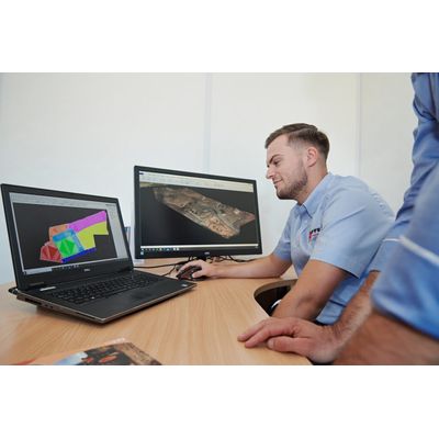
Detailed Blueprints Of Your Site That Identify Issues Early. By creating a detailed 3D model of your site, we identify any anomalies and prevent viability issues down the line. 3D Volumetrics are often produced later in a project, missing an opportunity to catch early errors and inform finished levels. We can integrate models directly into your Remediation Strategy and Earthworks Specification, which supports early Regulatory buy-in and prevents planning delays down the line.
Our engineers will also create a 3D model of the finished As-Built development platform to agreed formation levels.
Projects are managed collaboratively using Propeller software, so you can watch the site as it develops and get email alerts when your model has been updated. You will also receive issue-ready models to send to your follow-on contractors.
As part of the service, our in-house engineers can:
Carry out drone and topographical surveys of your site
Use topographical data to create a site outline, which is then built on with layers of information
Model detailed features such as build footprints and external areas
Check for often overlooked features such as retaining walls and boundary constraints
Advise on the precise volume of material you need to excavate or fill. (This can be phased to your build programme together with any identified surplus or shortfall)
Provide materials management tracking to ensure compliance with CL:AIRE protocol.
- By calculating any surplus or shortfall as part of the Remediation Strategy, we can prepare a MMP and engage Regulators early.
- Our team optimises sustainable re-use of material onsite, built into detailed MMPs in line with the CL:AIRE Department of Waste Code of Practice (DoW CoP).
- Using fissara waste management software, we can track waste movements from site in real time, providing a complete audit trail.