

- Home
- Companies
- Robert E. Lee & Associates, Inc. (REL)
- Services
- Surveying Services
Surveying Services
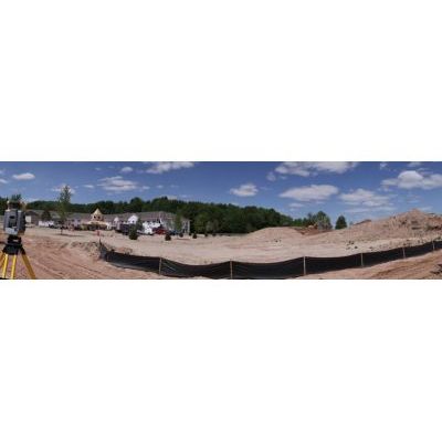
The land surveying division prides itself on the use of state-of-the-art technology, and in developing personal relationships with its clients. Since the establishment of the firm in 1956, the land surveying division has continued to lead the industry through the use of automation and new technology. As an example of this, the firm’s Robotic Total Station Combined with their Global Positioning System (GPS) is used by survey crews to work with high accuracy and within any coordinate system. The combination of this equipment allows the firm to complete projects efficiently without jeopardizing quality. Clients benefit by experiencing fast, dependable, and accurate service.
The firm’s well experienced surveyors are licensed in the state of Wisconsin and certified by the National Society of Professional Surveyors. The staff has a great eye for detail, provide comprehensive land surveying services for developers, municipalities, counties, state agencies, utilities and private industry. Survey crews work for clients independently and as technical support for engineers on in-house projects.
- Boundary Surveying
- FEMA related Surveying
- Construction Surveying
- Miscellaneous Surveying
- Survey Mapping
Boundary Surveying
- Area Development Plans
- Subdivision Plats
- Certified Survey Maps
- Condominium Plats
- Plat of Surveys
- Alta/acsm Surveys
- Easement Surveys
- Right-of-Way Plats
- Topographic Maps.
FEMA Related Surveying
- Elevation Certificates
- Letter of Map Amendments
- Letter of Map Revision
Construction Surveying
- Foundation / Building Layout
- Bridge / Structure Layout
- Utility Layout
- Street / Highway Layout
- Storm Water Drainage / Pond Layout
Miscellaneous Surveying
- Topographic Surveys
- Route Surveys
- Ground Control Surveys
- As-Built Surveys
Survey Mapping
- Geographic Information System (GIS) Mapping
- Municipal System Maps
- Parcel Mapping