

- Home
- Companies
- Bolton & Menk, Inc.
- Services
- Water Resources Engineering Services
Water Resources Engineering Services
Water resources engineering addresses a wide range of contemporary issues regarding water quality and quantity. Control of storm water runoff and flooding has long been a major concern for our clients and a key service area for Bolton & Menk, Inc. Today’s storm water projects are complicated by the need to consider water quality enhancement, downstream flood impacts, wetland degradation and increasing urbanization.
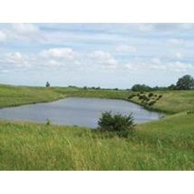
Surface Waters
The Bolton & Menk Water Resources staff is familiar with the legal and multi-jurisdictional issues and permitting requirements associated with Minnesota’s Surface Waters. The best approach is by developing and calibrating a runoff model of the existing conditions on a city-wide or watershed basis. Then, we use the calibrated model to test our innovative designs. This approach allows the designer to answer the inevitable questions that arise when a drainage pattern is altered. It also provides our clients with the background information and support they need to make informed decisions.
Modeling Techniques
Bolton & Menk is proficient with a wide variety of hydrologic and hydraulic modeling techniques. Bolton & Menk utilizes several data sources from multiple platforms to generate complex and comprehensive stormwater management system models for the clients we serve. Because every project area is different, we have developed our water resources staff to specialize in multiple software models to effectively serve client needs. We are fully trained and proficient with the latest versions of the following programs:
- XPSWMM, 1D and 2D
- Storm & Sanitary Analysis (SSA) for AutoCAD
- HydroCAD
- StormCAD
- MicroStation GeoPAK
- HEC-RAS and HEC-GeoRAS
- HEC-HMS and HEC-GeoHMS
- P8
- SWAT and ArcSWAT
- Qual2E, Qual2K
- GIS Geospatial Data
- CAD linework
- LiDAR Technology
- Aerial Photography
These programs can be used to model the impact of new developments, the hydrologic and water quality benefit of Best Management Practices (BMPs), the impact on floodplains, highway gutter spread widths, etc. They are also helpful in analyzing and proving the effectiveness of improvements that are part of Municipally Separate Storm Sewer System (MS4) permitting. Additionally, these programs allow us to perform spatial calculations, import GIS information into the model, and automatically assign attributes to the system geometry and hydraulic elements. Not only does this increase the level of accuracy of the model, but it vastly expedites the model building process.
Team Specialties
In addition to our modeling capabilities, Bolton & Menk provides wetland specialists, that can assist in wetland delineations, permitting, mitigation plans, banking plans, comprehensive wetland management planning and administering the Wetland Conservation Act on behalf of our clients who have chosen to be their own Local Government Unit (LGU).
We have Certified Floodplain Managers (CFM) on staff who are familiar with the National Flood Insurance Program. Our CFM staff can assist in working on all issues associated with floodplains in your area. From correcting flawed floodplain maps, securing Letters of Map Change (LOMC) and elevation certificates proving certain properties are not in the floodplain. We have also prepared Digital Flood Insurance Rate Maps (DFIRM) according to the standards set by the Minnesota DNR and FEMA.
Water Resources Services
Comprehensive Storm Water Management Planning
- Storm Water Treatment Basin Analysis
- Low Impact Development Design
- Rainwater Garden or Biofilter Design
- Sedimentation Basin Design
- NPDES Storm Water Permitting
- Comprehensive Storm Water Management Studies
- Storm Water Retention/Detention Basin Design
- Floodplain Interactions
Wetlands
- Wetland delineation
- Wetland permitting
- Wetland mitigation
- Agent for LGU Duties
Culvert and Waterway Analysis
- Culvert analysis
- Risk analysis
- Agricultural drainage
- Flood forecasting
- Erosion control
NPDES Permitting
- Comprehensive Storm water Management Plans
- Surface water pollution prevention programs
- Development of Ordinances and BMPs
- Assistance in meeting the 6 minimum measures of Phase II
- Study and Design of Flow Concentrations
- Using XPSWMM, SLAMM & P8