

Above - Aerial Topographic Mapping Software for Plant Design and Construction
Above offers a cutting-edge aerial topographic mapping service specifically designed to enhance plant design and construction projects. This service leverages both aerial and ground-based surveying methods to deliver high-resolution site maps, which include precise elevation data, in significantly less time and at reduced costs compared to traditional methods. As sites grow in size and complexity, Above’s integration of digital collaboration tools such as SolarGain and SolarGain Mobile enables effective teamwork between office and on-site teams. Users can annotate features, and link observations and site photos to exact geolocated points on the maps. Unlike generic mapping data from Google Earth, Above`s high-definition topographic data ensures accurate plant layouts, which can enhance energy yield and protect projected revenues.
Topographic mapping is essential for plant design and construction projects. Above’s aerial topographic mapping service captures high-resolution site mapping data in a fraction of the time and cost of traditional methods. Using a combination of both aerial and ground-based methods, Above delivers a high-resolution map of the site, including accurate elevation data.
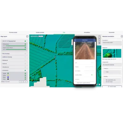
DIGITAL COLLABORATION TOOLS
Sites are becoming larger and more complex, so keeping track of potential design challenges or site investigations is harder than ever. Ou SolarGain and SolarGain Mobile apps give office and site teams the environment to collaborate more effectively with site terrain data. Teams can annotate features and associate observations, tasks and site photographs to precise, geolocated points on your maps.
Above’s Topographic Mapping vs Google Earth Mapping Data
Design teams often use Google Earth mapping data as their terrain layer. Developers may pay a financial penalty as, without sufficient topographical accuracy, the As Built layout may fail to achieve its projected PR, leading to reduced energy yield and revenues.
In the table across, we show the financial impact of building your plant using a Google Earth desktop design.
Deliverables
Digital Surface Model (DSM)
A 3cm/px digital elevation model of the whole area, where every pixel is accurately located in 3D space: 2D map coordinates plus elevation above sea level.
Digital Terrain Model (DTM)
A Digital Terrain Model is created by interpolating any data points below vegetation (crops), trees or buildings.
Orthomosaic
A map-quality image is created by stitching together the hundreds of images taken by the drone on site.
2D CAD Drawing
We provide linework for your site, including contours and labelled layers of your most important features. We can also perform ground-based surveying of specific features to include in the CAD, if required.
Integration with SolarGain and SolarGain Mobile
Development teams can store, and share geolocated site visit data, ensuring it is preserved and used for strategic decisions. Office teams can annotate site locations of concern for further on-site investigation by your team or sub-contractors using SolarGain Mobile Task Lists.