AGPS-Dirt - Version Pro -In-Field Level/Multi-Slope Software
FromCook`s AGPS LLC
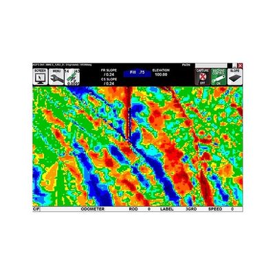
Design efficiently In-Field Level/Multi-Slope or Import Seamlessly from Most 3rd Party Design Programs, Color Cut/Fill Map with Dynamically Updating Grid, Elevation and Slope Machine Control, Real-Time Design Slope Information, Real-Time Cut/Fill Information, Background Drawings or Images.