
W_GeoSoft
W-GeoSoft - Version Digitize_BMP -Conversion Module
FromW_GeoSoft
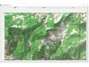
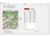
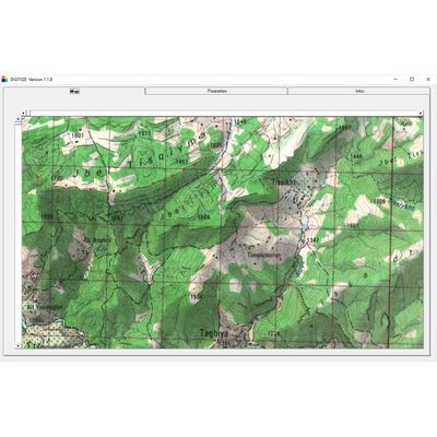
With Digitize_BMP allows you to display a map or picture (BMP or JPG) and pick XY value along a road, any limit. Data format can be degree, minutes, seconds, degree and decimal are kilometric grid. Coordinates are saved in a text file.The software is user friendly and can be used very intuitively. Digitize_BMP run under all 64 bits Windows.
Most popular related searches
Conversion module from usual system is available (Degree min sec, SWISS grid, UTM, LT3, LT93, ED50 NTF, WGS84, Lambert...)
- Select the type of data (Degree, kilometric grid..)
- Select a map (BMP or JPG)
- Select the coordinate system enter map corner coordinates
- Display the map and start picking (Left button to remove a point)
- Save the data file
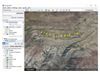
- Optionally display the data on GOOGLE Earth