
TatukGIS - Desktop GIS Editor
General-purpose desktop GIS software for geospatial data creation, editing, mapping, and analysis, providing the tools and features most GIS users require. A powerful built-in Python scripting environment enables customization and adding feature extensions as plug-ins.The TatukGIS Editor is a professional, general-purpose desktop GIS software for geospatial data creation, editing, mapping, and analysis, providing the tools and features most GIS users require in a product that is easy to learn and use. A powerful built-in scripting IDE, exposing the full TatukGIS API, enables customization and feature extensions as plug-ins
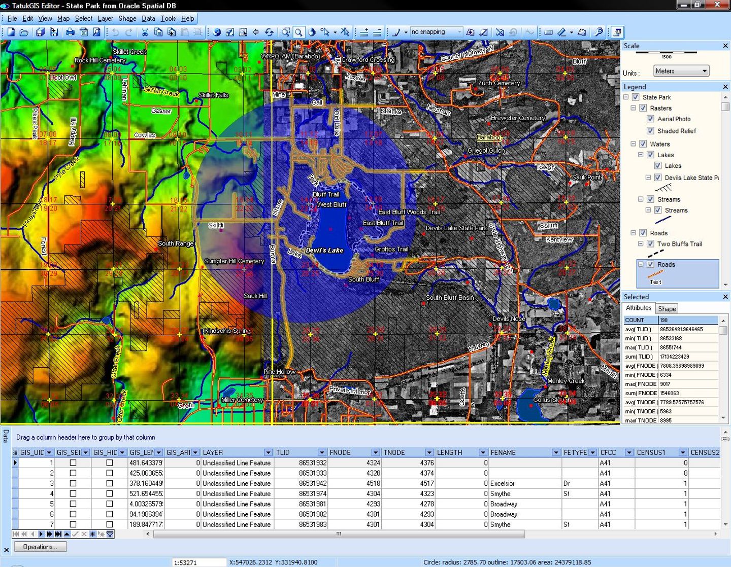
The Editor natively renders 75+ geospatial industry data formats and web services (WMS, WFS, WMTS, web tiles). It writes/exports geospatial data to 35+ vector, image, grid, and database layer formats, including advanced spatial databases (PostGIS, Oracle Spatial, MSSQL Spatial and others). IFC file support enables using BIM data in GIS projects.
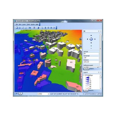
Features include comprehensive layer properties, legend, and scale controls, extended line style editor, editing tools for vector geometry and attributes, vector snapping, topological error correction, 5,000+ coordinate systems, on-the-fly reprojection, layer rectification, advanced labeling, built-in map symbols library, thematic mapping, color ramps, filters, buffers, charts, binning and dynamic shape aggregation, SQL and spatial queries, data classification methods, layer statistics, vector-to-grid interpolation algorithms, raster algebra engine, operation pipelining, viewshed & above-ground-level (AGL) visibility analysis, slope analysis, point cloud-to-grid conversion, database joining, 3D visualization, GPS tracking, printing, and much more.
The Python scripting IDE fully exposes the vast TatukGIS API with hundreds of classes and thousands of documented methods and properties designed for professional GIS development, making the Editor also a powerful geospatial development tool. Scripted plug-ins are easily deployed to other users.
The TatukGIS Editor is the same as free TatukGIS Viewer product but with important additional features relating to editing/creating data, spatial databases and DB joining, 3D visualization, BIM features, scripting/customization, and layer rectification. See the Editor/Viewer features comparison for details.
Volume discounts are available.