

Drone Harmony - Terrain Mapping and Surveying Software
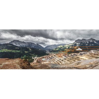
Map mines, quarries, forests, and other complex terrains with ease using the most sophisticated aerial terrain mapping features on the market. Guarantee perfect mapping results even in the most complex topographies by using custom terrain data to automate flight planning and execution.
Skip the climbing through rough terrain - Work with Drone Harmony instead. Your benefits:
Input Your Custom Data
Base your plans on the most accurate terrain data available. Use custom, or in-app data to represent the terrain model for your project.
Get High Quality Data
Full coverage and careful terrain following are guaranteed by optimization algorithms - even in extreme topographies, such as cliffs and steep mountains.
Full Control
Adjust high-level parameters to achieve your exact mapping goals. Combine nadir and oblique images for better mapping of complex areas.
Scalable Solution
Flight plans can be shared and repeatedly flown. Train beginner pilots in less than 30 minutes.
Visualize Terrain in 3D
Plan and visualize both your terrain data and all flight plans in 3D in Drone Harmony Web.