
Datumate
DatuBIM - Easy-to-Use Construction Drone Software
FromDatumate
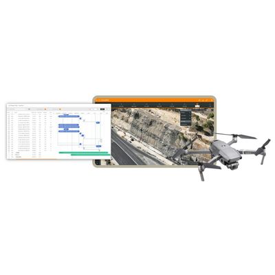
DatuBIM is an automatic, cloud-native SaaS construction data analytics and management platform based on an AI and photogrammetric drone mapping engine. This collaborative platform turns your drone and laser scanning data and images into survey-grade 3D models and maps. These accurate replicas of your site, when combined with detailed engineering and progress reports, allow for ongoing comparisons against designs and previous as-builts. Furthermore, the platform provides in-depth analytics and insights. As a result, you can enhance transparency and collaboration among all stakeholders, make well-informed decisions based on concrete facts, and more effectively manage and monitor project progress from any location.
Most popular related searches
laser scanning
drone scanning
data analytics platform
construction data management
analytical data management
mapping drone
laser imaging
- Turn your drone and laser scanning data into analytics and insights
- Leverage the power of AI to digitize your construction site
- Track work progress, detect deviations and prevent rework
- Enhance collaboration, reduce uncertainty and improve efficiency
- Do more with the same resources in less time