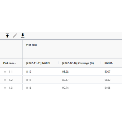
All geospatial layers, along with other file types, can be converted into tabular data, facilitating the analysis of multiple variables. Spreadsheets can be ingested and simultaneously downloaded in CSV or XLS format.