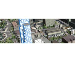
Esri CityEngine
Esri CityEngine is a stand-alone software product that provides professional users in architecture, urban planning, entertainment, GIS and general 3D content production with a unique conceptual design and modeling solution for the efficient creation of 3D cities and buildings. Create stunning city models in less time with Esri CityEngine software—the tool of choice for 3D city modeling in urban planning, architecture, simulation, game development, and film production. CityEngine delivers a full suite of industry-leading procedural tools to aggregate geospatial data, lay out and edit street networks, generate and modify buildings, create 3D road profiles and distribute street furniture, control the shape of the skyline, and analyze urban planning projects.
Share Smart 3D City Scenes
CityEngine scenes can be published directly on the web for sharing 3D models, analysis results, or design proposals with decision makers or the public.
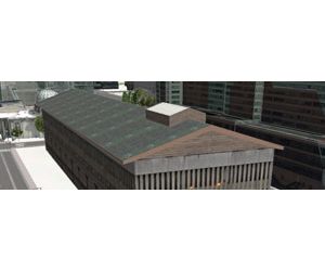
Easy-To-Use Editing Tools
Easy-to-use editing tools for the quick sketching and texturing of 3D building models.
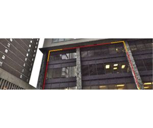
Facade Texturing
Intuitive and effective tool for the preparation of facade textures from ground based facade images, perspective correction, and region selection are done in one step.
Instant Report Generation
To compare planning proposals and analyze designs, customized rule-based reports can be generated in order to automatically calculate quantities such as density or grow floor area.
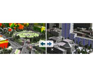
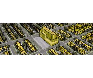
Visualizing 3D Zoning Rules
CityEngine allows you to specify, visualize, analyze, and store zoning regulations in 3D.
Integrated with ArcGIS
CityEngine fully supports the Esri file geodatabase (including textured multipatches) and the shapefile format. Users can import/export any geospatial vector data.