

- Home
- Companies
- CivilGEO, Inc.
- Software
- GeoHECRAS - 3D HEC-RAS Modeling ...

GeoHECRAS - 3D HEC-RAS Modeling Software
Rapidly construct HEC-RAS models from a variety of data sources. GeoHECRAS significantly speeds up HEC-RAS model creation and review, producing better and more accurate results. Compute water surface profiles for steady and unsteady flow models, bridge and culvert roadway crossings, FEMA floodplain encroachments, stream restorations, inline reservoir structures, off-channel storage areas, and much more.
- Easy to Learn and Use
- Work Directly on the Map
- CAD & GIS Integration
GeoHECRAS is an AutoCAD, MicroStation and ESRI ArcGIS compatible interactive 2D/3D graphical user interface data wrapper to the US Army Corps of Engineers HEC-RAS software.
Import a variety of different data quickly and easily into HEC-RASImport existing Army Corps HEC-RAS models and quickly georeference them to real-world maps using included georeferencing tools.
Work simultaneously on multiple HEC-RAS modelsWork with multiple HEC-RAS projects simultaneously using the Multiple Document Interface (MDI), including copying and pasting of cross sections and other data between HEC-RAS projects.
CAD & GIS Integration
Integrate HEC-RAS directly with AutoCAD drawing files, Bentley MicroStation drawing files and ESRI ArcGIS map data.
2D & 3D Viewing and Editing
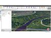
Shift seamlessly between 2D and 3D viewing perspectives to more clearly identify modeling issues and make changes.
Digital Terrain Cross Section Cutting
Extract HEC-RAS cross sections from 3D digital elevation terrain data.
Easy to Learn and Use
Interact graphically with all HEC-RAS model elements.
Work Directly on the Map
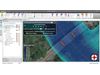
Blend Google or Bing online maps and high-resolution aerial imagery files directly into the HEC-RAS model.
CAD & GIS Integration
Integrate HEC-RAS directly with AutoCAD drawing files, Bentley MicroStation drawing files and ESRI ArcGIS map data.
Digital Terrain Cross Section Cutting
Extract HEC-RAS cross sections from 3D digital elevation terrain data.
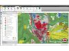
Floodplain and Floodway Mapping
Generate floodplain and floodway mapping from HEC-RAS results and 3D digital elevation terrain data.
1D and 2D Flow Models
Quickly build 1D and 2D HEC-RAS models using the provided CAD/GIS tools.
2D Mesh Generation and Refinement
Create either rectangular or adaptive meshes, depending upon the project requirements.
Included Land Use Coverage
Complete land use coverage is provided for the USA at an approx. 100 x 100-foot grid cell size.
Automated GIS Mapping Functions
Define bank stations, flow lengths, ineffective flow areas, conveyance obstructions, levees and other data.
Cloud-Based Mapping Services
Utilize world-wide high resolution 3D digital elevation terrain data from map services.
2D & 3D Viewing and Editing
Shift seamlessly between 2D and 3D viewing perspectives to more clearly identify modeling issues and make changes.
MDI Multiple Model Editing
Load, edit, and run multiple HEC-RAS models simultaneously.
More Accurate Models
Reduce time wasted with imprecise data. Easily integrate field collected data in varying formats.
Purpose-Built HEC-RAS Tools
HEC-RAS specific tools offer a more efficient way to create and analyze rivers, streams, bridges, culverts, inline structures, and more.
Stunning Visualizations
Create stunning visualizations directly from the software of different design alternatives to help better understand the impact of the design.
Full HEC-RAS Model Support
Compute HEC-RAS steady and unsteady flow results directly within the software.
Unlimited Undo and Redo
Correct mistakes easily with unlimited Undo and Redo capability.
Expert Technical Support
Toll-free 24-hour 7-day a week unlimited technical support by experienced HEC-RAS modelers is just a phone call away. Quickly resolve your HEC-RAS modeling questions and complete your engineering project—our skilled, professional engineers are here to assist you.
Powerful 64-bit, Multi-Core Support
Handle larger projects with powerful 64-bit, multi-core, parallel processing support.
Complete Reporting
Complete HEC-RAS reporting is provided, including cross section plots, cross section tables, profile plots, profile tables, and more.
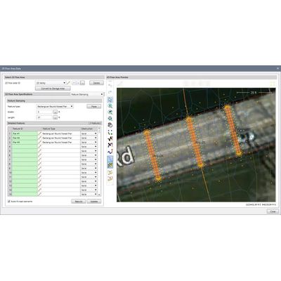
What-If Scenario Manager Analysis
Compare different engineering models, such as existing and proposed bridges, river realignments and restorations, and more.