


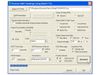

Geomar - Version TrackMaker31 -Field Data Acquisition Software
The Geomar TrackMaker31 system consists of two programs: field data acquisition component (NAV31) and the Windows (98/2K/XP) based data processing software (TrackMaker31). The program NAV31 is designed for Allegro field computer (NAV31P for Pro4000 is included), although, if necessary it can be used with any other IBM compatible computer running an MS DOS operating system and equipped with two serial ports. TrackMaker31 software works with virtually any GPS receiver by supporting NMEA messages: GGA, POS, GLL, LLQ, LLK, GGK, and Leica Robotics Total Station TPS1100, and collects EM31 and GPS data into one file simultaneously, while providing a graphical view of the collected GPS positions to better control the survey line direction. A profile view of the collected EM31 data is provided for the improvement of field data quality analysis.
View from NAV31 program running on the Allegro Field PC
- Profile Mode
- Navigation Mode
The NAV31 also provides a view of any previously collected data files with a Geonics instrument that is supported by the TrackMaker or Multi software and will assists the operator to return to previously collected stations. This allows for the easy and fast location of the last recorded positions, as well as fill any gaps in the survey coverage, insert additional survey lines with finer spacing in critical areas, or simply repeat survey lines with another instrument.
In addition to acquiring EM data the system will convert any Field PC to a stand-alone logger for GPS/DGPS data collection, taking away the need to purchase additional more expensive GPS components
Display functions:
- Displays locations of logged GPS positions and current location of an operator in real time while in Navigation mode
- Scale of map is user specified (meters or feet) and it scrolls automatically once the end of the screen is reached
- EM31 conductivity and Inphase data is displayed with moving graphic bars and in numeric form, EM31 dipole mode and instrument range also monitored
- Current GPS antenna position in Latitude/Longitude, type of differential corrections (AGPS, DGPS, RTK, Phase), PDOP or other equivalent parameter (depends on NMEA used), number of satellites, and number of GPS positions in the file
- Positions of interpreted anomalies which are entered as an ASCII file allow you to navigate to points of interest
Survey parameters:
 Survey modes supported (Auto, Wheel, or Manual)
- Integration of readings available in Manual mode (up to 100 readings per station)
- Maximum rate of data acquisition is 10 Hz (assuming 1 Hz GPS output)
- New Line, New Station, Comment entry
- Change of scale in Navigation and Profile modes at any time
GPS functions:
 Configuration of logger serial port to
- accommodate any GPS settings
- GPS output monitoring
- Support for NMEA messages: GGA, GGA/GSA, GLL, POS, LLQ, LLK, GGK, and stream from Leica Robotics Total Station TPS1100
- Option to act as a stand-alone GPS logger, which would allow data to be collected in GXY file format (compatible with any TrackMaker or Multi program)
- Offset for GPS antenna in any direction
Position EM31 readings and create XYZ file based on standalone TrackMaker31 file:
- Apply GPS antenna offset in any direction (as entered in the field with option of correcting this parameter during data processing)
- Include elevation data with correction for antenna height
- Filters the quality of positioned data based on GPS parameters as PDOP (or equivalent) and the degree of differential corrections
- Field QC parameters (Quality Indicator, number of Satellites and PDOP) are written into the generated XYZ file
- Further enhancement of the collected EM31 readings position is obtained by specifying the GPS Time Gap and GPS Minimum Interval
- Choice of coordinates in generated XYZ file: Geodetic coordinates (Latitude/Longitude in degrees) or in UTM coordinates (WGS 1984 datum in meters, feet, or US Survey feet)
Position EM31 readings and create XYZ file based on external GPS file:
(This function is used when real time GPS differential corrections are not available, or when further post processing of GPS data may improve positioning accuracy)
- Apply GPS antenna offset in any direction (as entered in the field with option of correcting this parameter during data processing)
- Further enhancement of the collected EM31 readings position is obtained by specifying the GPS Time Gap and GPS Minimum Interval
Miscellaneous:
- Convert TrackMaker31 files to Geonics DAT31 format
- Convert TrackMaker31 files to general format ASCII file
- Convert GXY file to ASCII file containing positions
- Retrieve and position field comments from TrackMaker31 file
- Apply System Time Constant delay in generated XYZ file
- Transfer data file from field computer to PC
- View TrackMaker31 file contents