
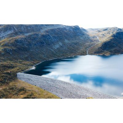
Rezatec - Geospatial AI for Landslide Risk
The power to see unusual changes between routine structural surveys. Deploy your investigation and maintenance resources to the right place at the right time. Assess risk. Act fast. Landslide Risk identifies and monitors key landslide indicators and determines the highest risk areas cost-effectively, at scale. It fuses multiple satellite, geospatial and trigger-event data, like weather, seismic and construction, with the most advanced analytics available. Its year-round monthly data insights detect areas of landslide risk across your entire dam infrastructure, giving you the foresight to stay on top of issues, deploy the right maintenance resources, and manage cost and safety impacts.
Reduce safety issues
- Remote monitoring
- No site visits needed
- Comprehensive, accurate data
Identify highest risk areas
- Monitor landslide indicators
- Year-round insights
- Stay on top of risks
Prioritize resources
- Identify key risk areas
- Fix ahead of time
- Mitigate cost & safety issues
The U.S. Geological Survey estimated annual losses to be between $2 billion and $4 billion per year. However, landslide costs across the country are not currently tracked or measured in a uniform way by any one agency, so this figure is likely to be an underestimate.
With changing risk metrics and an increased focus on risk management, dam owners are pushing for new approaches to understand their risks and potential liabilities. Ultimately, managing the challenges of risk invariably comes down to monitoring.
Until now, monitoring areas around the dam that are prone to or suspected of potential landslide has been a largely manual operation. The safety issues associated with deploying investigation resources in the form of engineering personnel and hardware are well understood. Using traditional ground techniques, it can take weeks to collect measurements which, ultimately, and be inconsistent and difficult to analyse. Tracking slow, continuous movement that may be the very beginning of a landslide event, tracking motion, cumulative change and speed of change to a high degree of accuracy is challenging.
Other methods, such as aerial monitoring use photography to see relative change, but again it’s tricky to accurately measure change over time. In addition, cost means many dam operators are only able to run aerial monitoring once a year at times of potential trigger events such as heavy rain and freezing. Drones can capture high-precision landslide images and digital elevation data that provide new avenues for landslide feature interpretation, inputs into numerical simulations and susceptibility assessment. While hugely valuable, collecting this data is expensive and time consuming.
For many dam owners and operators, turning to emerging techniques and technologies that can provide an early warning risk assessment prior to deploying investigation resources is proving hugely beneficial.
Landslide Risk is the only Dam Monitoring module of its kind that remotely provides year-round, monthly, accurate risk monitoring. It fuses multiple satellite, geospatial and trigger-event data, with the most advanced analytics available, enabling you to stay on top of risks, focus resources and ensure safety.