

Hyperspectral Imagery Software
Pixxel's hyperspectral imaging satellites are uniquely designed to beam down data in hundreds of wavelengths to detect problems that are invisible to today's satellites. The constellation is designed to provide global coverage at a revisit of every 24 hours.
Pixxel's hyperspectral imaging satellites are uniquely designed to beam down data in hundreds of wavelengths to detect problems that are invisible to today's satellites. The constellation is designed to provide global coverage at a revisit of every 24 hours.
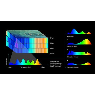
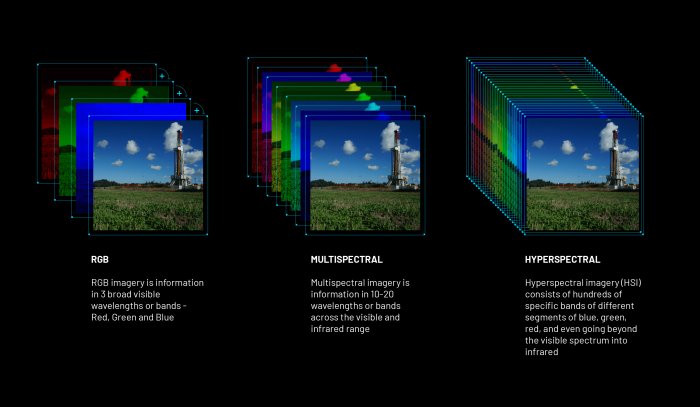
Hyperspectral imaging (HSI) is a technique that analyses a wide spectrum of light instead of just assigning primary colours (red, green, blue) to each pixel, effectively spectrally fingerprinting the Earth to provide more information on what is imaged.
The collected spectra are used to form an image in a way that each image pixel includes a complete spectrum.
Pixxel satellites are big performance packed in a very small package. Smart, lightweight, and technologically advanced versions of present-day satellites that reduce production and launch cost while expanding the depth of information received.
250 spectral bands
VNIR and SWIR
5M spatial resolution
Highest resolution commercial hyperspectral satellites
Daily Global Access
24-hour revisit