Land Change Modeler Software For Arcgis Software
Land Change Modeler Key Features
With Land Change Modeler, users can:
- Quickly map land change and trends
- Rapidly model future land change scenarios
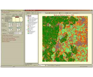
- Assess habitat risk and species impacts
- Model species distribution and biodiversity
- Perform REDD analysis for the estimation of carbon emissions from deforestation
- Generate biological corridor designs
- Develop reserve selection and design scenarios
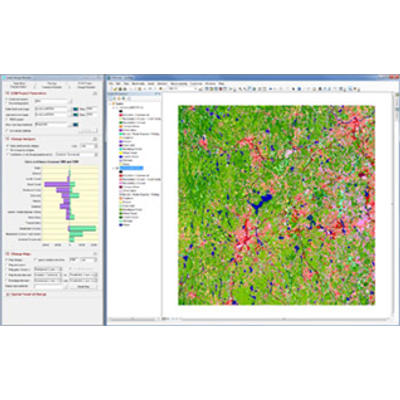
The Change Analysis panel provides a set of tools for understanding the nature and extent of landcover change, including graphs of gains and losses, net changes and contributions experienced by any category. A simple one-click interface provides the ability to generate rapid maps of change, persistence, specific transitions and exchanges between categories.
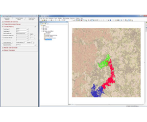
Generate biological corridors for species planning and design scenario modeling that are optimized for habitat suitability, ecological significance and protection status.
The Habitat Assessment panel maps areas into categories of primary and secondary habitat, primary and secondary potential corridor and unsuitable lands based on landcover and habitat suitability. The user specifies parameters such as home range size, buffer widths, and gap crossing distances within range and during dispersal.