

SoftWright - Land Use Module
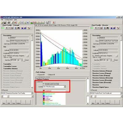
The Land Use module imports USGS National Land Cover Database (NLCD) files and Global Land Cover (GLC) files and uses them in the radio coverage predictions and link analyses. Loss values may be defined for any frequency ranges for each specified type of land use to permit the inclusion of localized environmental conditions in predicted system performance. Recommended loss values are readily available. The USGS NLCD files categorize land use attributes, such as Urban, Agricultural, Forest, etc. When the files are imported into the TAP format, TAPcan determine the classification at a given set of coordinates.
In addition, TAP includes a Land Use Loss Database that correlates the land classification with a loss value as a function of frequency. When TAP is used for an area coverage study or single-point field calculation, the environment of the receiver location can be determined from the Land Use data, and a user-specified loss value can be applied. For example, if an additional loss of 3dB within a certain frequency band is to be included whenever a receiver location is in a forest area, and 6db when in an urban area, the Land Use Loss Database stores that condition. At the same time, a loss of 7dB for forest and 12dB for urban may be stored for use in a different frequency band. This approach allows great flexibility in applying the effects of the land use information to TAP studies.