

Datamine
Most popular related searches
geotechnical analysis
safety hazard
geological mapping
geology software
slope stability
geotechnical
mineralogy analysis
mineral analysis
mapping software
geotechnical software
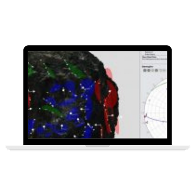
Cost efficient geological mapping
Uses off the shelf digital SLR cameras and fixed focal length lenses.
Increased safety
The whole face can be photographed and mapped from a safe distance.
Fast & easy to use
Take photos easily and rapidly with only 2 days of training and basic digital camera knowledge required.
Highly accurate
Precise and accurate scaling, positional and angular measurements for reliable geotechnical analysis.