RanMarine Technology
- Home
- Companies
- RanMarine Technology
- Software
- RanMarine Connect - Proprietary ...
RanMarine Connect - Proprietary Web-based Application Platform Software
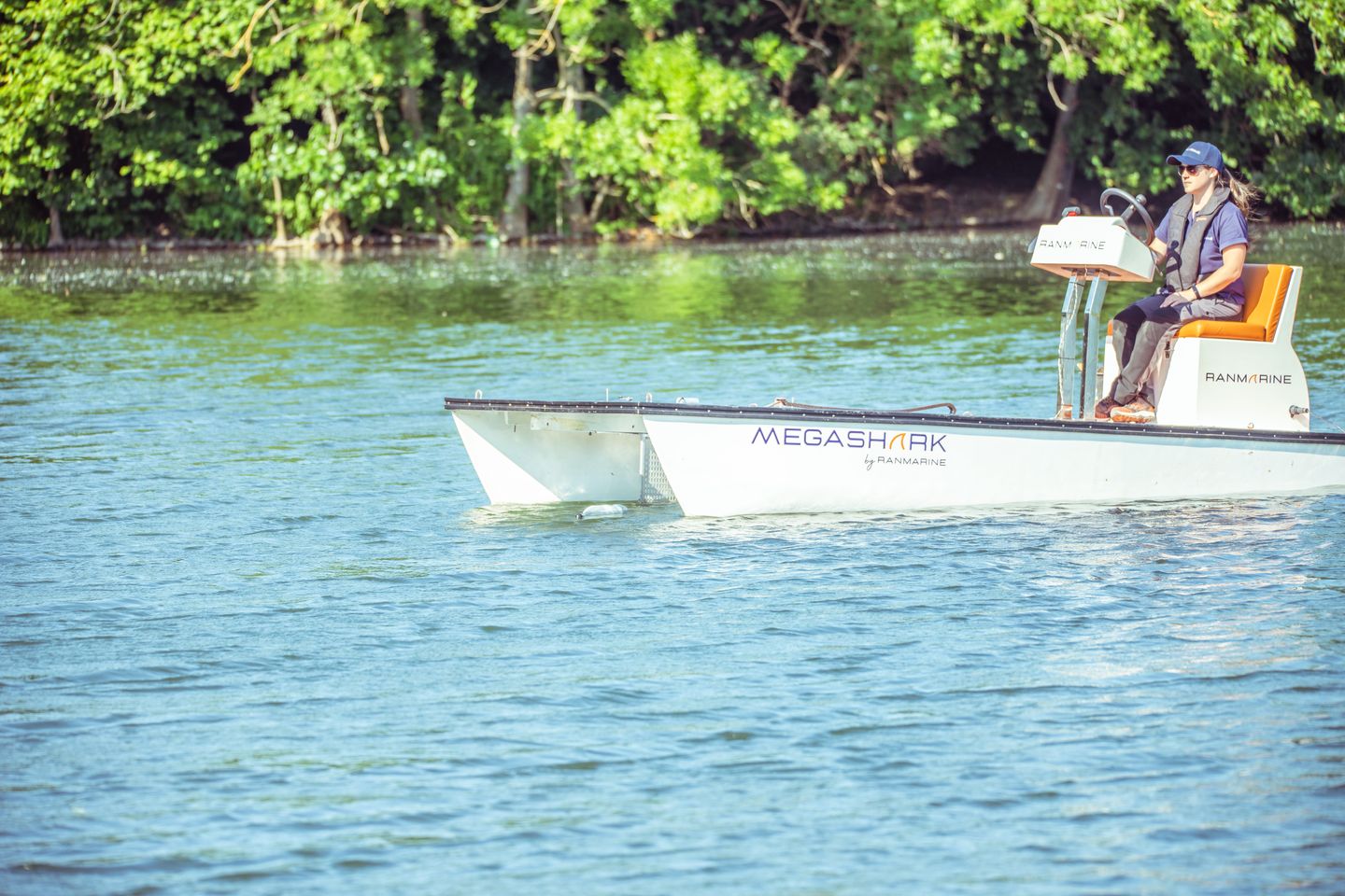
RanMarine Connect is a proprietary web-based application platform offering simple and intuitive control functionality for our autonomous range of products (e.g. WasteShark and SharkPod), in addition to data access and visualization tools for the information that is collected by sensors.
Most popular related searches
data visualization
sensor data
data visualization tool
autonomous drone
GIS data
GIS data maps
environmental impact measurement
environmental monitoring
environmental impact
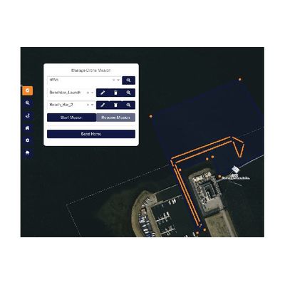
Simple Autonomous Control
- Manage multiple operating locations & routes with ease
- Create, save and send your autonomous vessel on routes at the click of a button
- Pause and resume missions at any time
- Create a home location so your autonomous vessel knows where to return at the end of its mission, or when it needs to recharge its batteries
Flexible Data Access: Dynamic and real-time, or historic
- View data-feed in real-time
- Automatically record trash and data harvesting missions
- Geo-referenced sensor data for accurate observation
- Configure alerts when a sensor threshold value is breached
Vessel Control
- Product Dashboard
- Missions Plan & Log
- Sensor Date Insights
- Impact Measurement
Environmental Insight
- Control : Set your drones out on an autonomous path
- Drones : View the status of your drones
- Monitor : Monitor the data of your drones
Impact report
A report generated using data from between two chosen dates. Data has been gathered starting from May 3, 2023 and ending on May 3, 2023.
- 3 mission(s) completed.
- 1 drone(s) used in these missions.
- 2 kilometer(s) covered in total.
- 100 kg of biomass captured
- 128 liters of Man-made Trash captured
- 120 liters of Mix (Man-made & Biomass) captured
Mission data forms the basis for impact reporting. Insight into a RanMarine’s blue tech investment, and how this is making a measurable difference (by hour, day, month or year).
- Mission Planning : Route creation across multiple locations.
- Vessel Control : Start, end, pause & resume vessel missions.
- Dynamic, real-time data view : GPS referenced data updates
- Impact Reporting : Consolidated view of mission data (e.g volume of trash collected) over time.
- Data Visualization & Access : GIS referenced data on a map, in a graph or in raw format.