

QZ Solutions Sp. z o.o.
- Home
- Companies
- QZ Solutions Sp. z o.o.
- Software
- QZSolutions - Version QuickZones - Soil ...
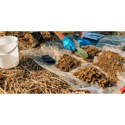
QZSolutions - Version QuickZones -Soil Samples Collect Software
Collect soil samples accurately based on analysis of multi-year satellite images.
Most popular related searches
soil sample collection
soil sampling
satellite image
sample collection
sample management
GIS software
field analyzer
analysis system
mapping system
soil mapping
Technology
A map of the field, which is created on the basis of historical satellite images.
Analysis
We divide your field into areas of poor and good biomass growth.
Result
We provide a ready-made, precise map for soil sampling.
- Manage Customer Fields Better
- QuickZones is an innovative service,
- analyzing the field for productivity using
- 5 different algorithms:
ALGORITHM 1
ALGORITHM 2
ALGORITHM 3
ALGORITHM 4
ALGORITHM 5
What is QuickZones?
Quick Zones is a service that generates a field productivity map.
The map shows significant differences in vegetation index values, which are used to determine soil sampling locations.
In the image below, we show an example of a field analysis, based on historical satellite images from 6 years.In green we see the areas where it yielded the best, and in red where it yielded the least.
By using QuickZones you gain:
- Historical analysis of customer field productivity in minutes
- Increased accuracy of soil sampling zone delineation
- File compatible with GIS software
- Additional information in the context of variable fertilization