OptaCAT - Satellite Imagery and Digital Intelligence Software
Get satellite imagery and digital intelligence in restricted areas to speed up the claims process and allow your customers to resume their day-to day lives as quickly as possible.
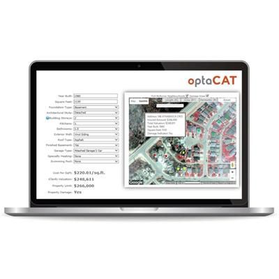
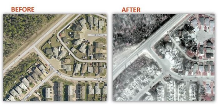
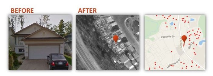
OptaCAT leverages analytics and machine learning technology to deliver geo-coded mapping with pre and post loss imagery on customers’ entire books of business. High resolution mapping helps identify changes to insured areas as well as an initial indication of damage.
Full navigation capabilities provide geo-coded property information delivered through iClarify including carrier-provided details such as Coverage A, Contents Limit, Attachment Point, Policy Limits, Deductibles, and more.
Opta’s assessments include information pertaining to Insurance-to-Value/Replacement Cost, year of build, square footage, roof type, architectural style, number of storeys, exterior wall type, foundation type, number of bathrooms, number of kitchens, garage type, and if basements are finished.