
Verisk - Version UKLand -Spatial National Land Use Database
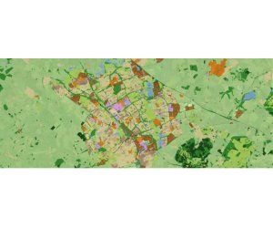
The database, comprising 27 classes, is used for regional analysis and planning by Government, Planners, Developers, and Property companies to improve planning and decision making. If you are searching for specific categories of land, for example, retail parks, or large areas of industrial land away from urban areas, UKLand can help.
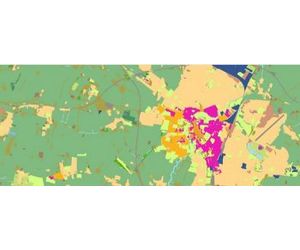
A version of the database is also used to plan and develop wireless radio networks for Telecom companies and mobile network operators. Delivered as a Telecoms Clutter database, the data can be used within standard radio planning and optimisation software.
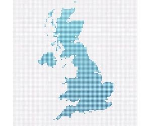
UKLand is available for the whole of Great Britain and Northern Ireland.
The national land-use database includes a basic, high-level land data classification (man-made, natural, agricultural or water) and a more detailed set of 27 classes. These are made up of the following:
- Natural areas (sand dunes, rockscapes, heath and moorland ....)
- A range of agricultural types (mainly crops, mixed-use, vineyards, glasshouses …)
- Woodlands (Deciduous, Coniferous, Mixed …)
- Built environments. (A range of urban densities, Business Parks, Industrial, Retail Parks …)
UKLand is available via download in standard mapping and GIS formats. For GIS users, display characteristics and standard style files are provided.