

TarGOST - Tar-Specific Green Optical Screening Tool
Dakota has developed the Tar-specific Green Optical Screening Tool or TarGOST®. TarGOST was developed exclusively for detection of coal tars, creosotes, heavy crudes, and tank bottoms. Following a comprehensive spectroscopic study of coal tar behavior, Dakota created this method which results in a monotonic response for coal tars on a variety of soils. Lab tests of TarGOST indicate the system is ideally suited for delineating the NAPL contaminated zones or source term at former manufactured gas plants (MGPs) and wood treating facilities.
The TarGOST system is designed specifically to overcome the low signal levels and often severe non-monotonic response observed on coal tars and creosotes with current UV-based fluorescence systems. TarGOST does not have the detection limits typically observed with the UV-based UVOST on the lighter molecular weight NAPLs, rather TarGOST focuses solely on mapping higher molecular weight NAPL contamination (LOD = ~100-500 ppm NAPL on soil).
TarGOST has been confirmed to be useful for logging:
- Coal tar (coking, former manufactured gas plants, etc.)
- Creosote
- Crude oil
- Bunker
- Heavy distillate
- Dripolene (olefin plant aromatic byproduct)
- DEHP/BEHP (some - not all)
- Biodiesel
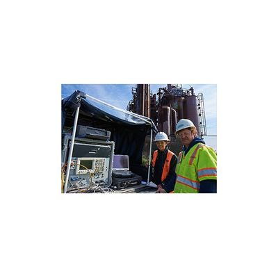
Dakota is currently offering TarGOST site characterization service of former manufactured gas plants (MGPs) and wood-treating facilities. Since the first full-scale site characterization project in June of 2003, the system has been successfully applied and validated in a wide variety of site conditions and deployment platforms, including Geoprobe and CPT. Barge deployment is now becoming fairly routine and continues to be a growing deployment platform for TarGOST.
Successful remediation/treatment systems require detailed knowledge of the NAPL distribution. TarGOST provides this knowledge at unprecedented speed, detail, and efficiency.
If you are interested in UVOST, TarGOST and/or DyeLIF, and are unsure which LIF technology is most suitable for your site, feel free to Contact Us. For a general overview of the basic elements of the field investigation process, please see the General Investigation Process page.
Free Sample Check
We will usually request a sample of your site`s NAPL(s) or, less optimally, NAPL-contaminated soil. A typical sample is a partially full 40 ml VOA, well labeled. We will analyze the sample with our LIF systems and quickly be able to tell you if LIF is a viable investigative tool for the site.
Be sure to include a detailed description of the product (any unusual hazards, etc.) and your full contact info. If your material is hazardous (PCBs, etc.) or we receive an excessive volume, you will be responsible for return shipment or for disposal by a local waste management company.
For a pdf with detailed shipping instructions, click here.
Hole Locations
Some customers like to pre-plan the hole locations, mark the site accordingly, and record all relevant x-y and elevation data. A plan of bounding the contamination based on results determined on-site is also viable. Regardless if the hole placement follows a grid or bounding procedure, Dakota strongly prefers to start LIF projects in what is believed to be the heart of the contamination. This gives everyone involved valuable information regarding how well the NAPL is going to respond to LIF delineation.
Confirmation Sampling
Dakota recommends discrete sampling at 10% of the hole locations if semi-quantitative values are to be assigned to the LIF signals. Soil sampling can be reduced to approximately 5% of total hole locations as a ground-truthing exercise. If an extensive sampling program is planned, the client should consider including a local driller and/or a second rig. Remember to build sampling time into your scope of work. We also recommend that you consider obtaining LIF responses to homogenized splits of your samples. If your site has heterogeneous lithology (very typical), the chance of you sampling soils/NAPL that are representative of that which the LIF probe passed through are near zero! If heterogeneity exists, and you try to compare lab results to LIF %RE of adjacent logs rather than LIF %RE of those same samples, the correlation will be poor (the expected result). We recommend doing duplicate logs at roughly 10% of the hole locations to gauge site heterogeneity.
If Dakota is contracted to collect soil samples, it will be prudent to do all the sampling at one time, preferably as the final stage of the field activities. Using LIF data, impacted zones can be identified and targeted for sampling, eliminating the need for continuous cores.
Expected Production
UVOST and TarGOST productivity can range anywhere from 200 to over 400 ft/day. DyeLIF, UVOST+HP, and TarGOST+HP is generally 200 to 250 ft/day. MIP and HPT production is also typically in the range of 200 to 250 ft/day.
If the pushes are fairly deep (>30 ft), and the obstructions or rubble are minimal, then the average is on the higher end because we spend a lot more time actually probing, not moving around from location to location and/or trying multiple times to get holes started through rubble. Other factors affecting production are grouting requirements, surface pavement, surface topography, and vegetation.
Start-Up Time
When the LIF system first arrives on site, it is powered up, and tested for proper function. If it is in Dakota’s Geoprobe, the LIF system is simply powered up and we’re ready to begin probing after a very short warm-up. If a CPT or other direct-push machine is used, the LIF system is integrated into the delivery platform, rods are strung with the Dakota’s optical fiber cable, and proper depth measuring connections are made (about a 2 to 3 hour procedure).
Barge Productivity
LIF operations on a barge usually limit daily production to 50 to 200 feet of logged depth. Additional factors affecting barge productivity are: location accuracy requirements, subsurface conditions, water depth, and presence of current or tide.
Hole Locations
Once Dakota leaves, our customers may wish to survey all the LIF probe locations if it wasn’t done prior to the job. Getting good positional information, including elevation, is key to any future CAD and visualization efforts.
Additional Services AvailableConceptual Site Model Visualization Option
Dakota now provides the capability to view TarGOST, UVOST and Dye-LIF site characterization data in unparalleled resolution. With our 3D models, the client has full control of the camera and is not limited by viewing static images.
Advanced Data Analysis Using NNLS Option
Many natural geologic materials fluoresce. In order to effectively interpret LIF logs we sometimes need to separate NAPL fluorescence from false positives such as peat, meadow mat, algae, crushed limestone, wood, and shell hash. Non-negative least squares (NNLS) analysis provides an effective solution.
Written Report Option
Dakota can summarize all on-site activity as well as provide detailed log and waveform analysis in the form of a written report.
TarGOST® Log
A: Main Plot
Signal versus depth where signal is relative to the Reference Emitter (RE). For TarGOST data, the signal is scatter corrected due to tar’s non-linear fluorescence with increasing concentration. The fill color is based on relative contribution of each channel`s area to the total waveform area (see callout waveform). The first channel (blue) is always representative of the scatter.
B: Callouts
Waveforms from single depths or depth ranges showing the multi-wavelength waveform for that depth. Basic waveform statistics and any operator notes are given below the callout.
The four peaks (referred to as channels) are due to laser scatter and fluorescence at three wavelengths. Each channel is assigned a color. Various NAPLs will have a unique waveform fingerprint due to the relative amplitude of the four channels and/or broadening of one or more channels.
C: Scatter & Fluorescence Plots
The Scatter Plot is the scatter (channel 1) versus depth. Scatter routinely drops as tar concentration increases.
The Fluorescence Plot is the fluorescence signal (channels 2 to 4) alone versus depth. In this plot, the scatter channel is not used in the calculation of signal intensity or coloring. Note the coloring key at the top of the plot. Intensity unit is percent of Reference Emitter fluorescence. Varying soil or product can often be visually pulled-out from the background based on the fill color of this plot if scatter dominates the color of the main plot.
D: Info Box
Contains pertinent log info including name and location.
TarGOST+HP Logs
In addition to the features of the standard TarGOST log, the TarGOST+HP log shows injection pressure and a corresponding volume of injected water data directly on the log (far right columns). As with the standard TarGOST log, following data acquisition, the operator may output a jpeg image or pdf of the data. The operator also has control over the three callouts shown on the left side and the scale of the depth and signal axis. Click for a larger image.