
Techbase International
TECHBASE - Geotechnical Engineering Package
The TECHBASE Geotechnical Package was designed to perform all the essential tasks of the geotechnical professional. A sampling of these tasks is listed below. With TECHBASE, you can add more capabilities as your project advances, there is no need to buy another software package.
Most popular related searches
geotechnical software
geotechnical
laboratory testing
geological mapping
geotechnical data
laboratory data
groundwater modeling
slope stability
groundwater flow
color analyzer
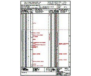
Logs
- Plot Geology as patterns and/or colors with descriptions.
- Plot Analyses as values, histograms or traces.
- Templates provided with software - or create your own.
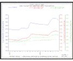
Graphs
- X-Y (Scatter) Plots
- Histograms
- Time Series Diagrams
- Ternary Diagrams - Triangular Plots
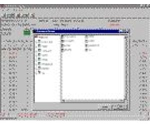
Laboratory Testing
- Store Laboratory data in a TECHBASE Database
- Define your own data parameters, limits, data type, inter-record calculations
- Special fields designed for Geotechnical Data
- Full filtering, searching, validating capabilities
- Report values in total, as subsets, averages etc.
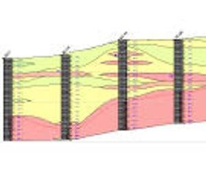
Cross Sections
- Plot Surveyed or unsurveyed holes
- Fence Diagrams
- Illustrate Geology as patterns or colors
- Show analyses as values, histograms or traces
- Cross, top and side views
Mapping
- Basemaps
- Topographic Maps
- Geologic Maps
- Drill Hole Location Maps
- Land Maps
- Maps of Land Features
Additional Capabilities
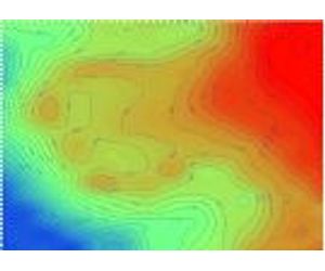
- Contour modeled or raw (XYZ) data
- Interactively edit graphics - add title blocks, move points etc.
- Convert data from one coordinate system to another "on the fly` while creating TECHBASE graphics
- Edit all graphics on screen
- Print graphics or save to a variety of transportable formats
- 6 months of unlimited technical support included in purchase
- Self-paced tutorial included in purchase
Expansion
Need more capabilities? No need to buy another software package. Purchase additional TECHBASE modules to:
- Model your data into 2D surfaces and 3D blocks
- Calculate tonages and volumes
- Digitize data directly into TECHBASE
- Calculate Slope Stability
- View your data with our 3D viewer - spin, rotate, zoom and pan through your project area producing stunning graphics
- Simulate pit slopes and topography
- Model groundwater flow
- And much, much more