

Techbase International
- Home
- Companies
- Techbase International
- Software
- TECHBASE - Groundwater Professional ...
TECHBASE - Groundwater Professional Services
The TECHBASE Groundwater Package was designed for groundwater modeling and quality evaluations. With this package you store data in the TECHBASE database manager. Then statistically analyze, graph, draw maps and cross-sections. Finally use the USGS MODFLOW program, as adapted to TECHBASE, to model your groundwater flow.
Most popular related searches
groundwater modeling
subsurface data
groundwater flow
geological mapping
monitoring well
groundwater data
well sampling
flow modeling
color analyzer
MODFLOW
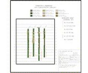
Logs
- Plot Geology as patterns and/or colors with descriptions.
- Plot Analyses as values, histograms or traces.
- Templates provided with software - or create your own.
Model Groundwater Data
- The USGS 3-D groundwater flow model "MODFlow" has been adapted for use with a TECHBASE database and is included in every TECHBASE Groundwater Professional Package
- MODFlow manual also available
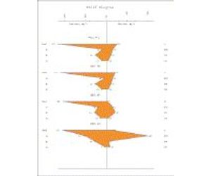
Statistics and Graphs
- Summary statistics
- Correlation and Regression analysis
- Cumulative frequency plots
- Piper, Stiff, Rose, Stereonet Diagrams
- Duplicate Data Analysis
- X-Y (Scatter) Plots
- Histograms
- Time Series Diagrams
- Ternary Diagrams - Triangular Plots
Model Static Data
- Composite (average) down hole data into intervals, rock types, benches or user defined variables
- Model your data using any of 7 algorithms to interpolate between data points including Inverse Distance, Krige, Trend Surface, Triangulation estimator and more.
- Populate 3D block tables or 2D cell tables using the TECHBASE modeling algorithms
- Locate data within boundaries such as land ownership limits
- Calculate Variography in support of Modeling Programs
Data Acquisition, Storage, Reporting
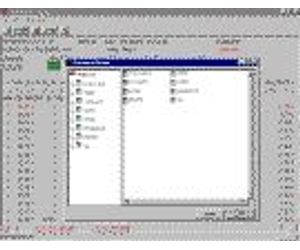
- Store subsurface data in a TECHBASE Database
- Load data from external files or enter data directly into TECHBASE
- Define your own data parameters, limits, type, perform inter-record calculations
- Special fields designed for subsurface Data
- Full filtering, searching, validating capabilities
- Excedence Reports
- Create reports of data in full, subsets, averages, totals and more
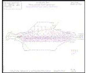
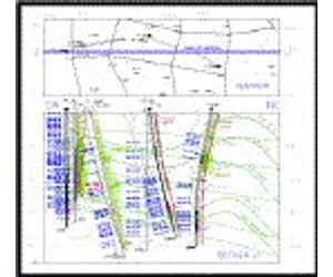
Cross Sections
- Plot Surveyed or unsurveyed holes
- Plot Geology as patterns or colors
- Plot analyses as values, histograms or traces
- Cross, top and side views
- Fence Diagrams
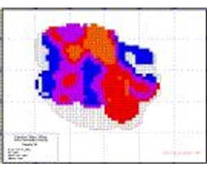
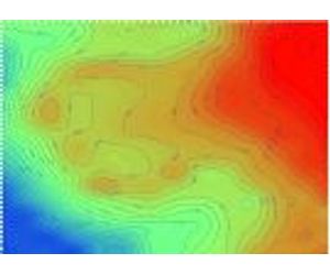
Mapping
- Vector maps
- Basemaps
- Topographic Maps
- Maps of monitoring wells
- Plot multiple values adjacent to wells, sample locations
- Geologic Maps
- Drill Hole Location Maps
- Land Maps
- Maps of Land Features
Additional Capabilities
- Digitize Data into TECHBASE using the sDigit program
- Contour modeled or raw (XYZ) data
- Interactively edit graphics - add title blocks, move points etc.
- Convert data from one coordinate system to another "on the fly` while creating TECHBASE graphics
- Print graphics or save to a variety of transportable formats
- 6 months of technical support included in purchase
- Self-paced tutorial included in purchase
Expansion
Need more capabilities? No need to buy another software package. Purchase additional TECHBASE modules to:
- View your data with our 3D viewer - spin, rotate, zoom and pan through your project area producing stunning graphics
- Simulate pit slopes and topography
- Add GIS and AutoCAD conversion Utilities
- And much, much more