

Umitron Pte. Ltd
- Home
- Companies
- Umitron Pte. Ltd
- Software
- Umitron - High-Resolution Satellite ...
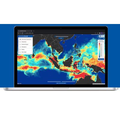
Umitron - High-Resolution Satellite Data Software
FromUmitron Pte. Ltd
Six useful parameters are available for all regions. Each of these are updated daily and offer high-resolution coverage.
Most popular related searches
DYNAMIC LEGEND
The legend automatically calibrates to your initial location and it can be refreshed to re-calibrate when you zoom in or out. It provides a unique color scale for each parameter that makes differences easy to visualize.
DEPTH FUNCTIONALITY
Use the slider to quickly change the water depth. Three depths are currently available: 0 metres, 5 metres, and 10 metres.
HISTORICAL/ FORECAST DATARESPONSIVE GRAPHS
Quickly change the date to see two days into the future or two days into the past