

Advanced Geophysical Operations and Services Inc. (AGCOS)
Version ZondMAG2D -2D Gravity and Magnetic Interpretation Software
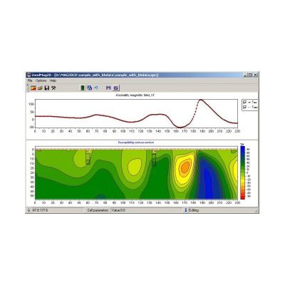
The program is designed for 2D magnetic and gravity 2D modeling and interpretation in two (2) versions: land/surface; airborne. Single and easily understandable data format is used in the program, but main known data formats are supported.
Most popular related searches
Several ways of data inversion could be used in ZondMAG2D:
- Smooth;
- Sharp;
- Block-smooth.
There are several ways to use priory geological and geophysical information in ZondMAG2D. There is an option to import and visualize the other geophysical methods results as well as borehole data. Options include:
- Put weights to the data;
- To fix property of some cells;
- Put the limits on the cell’s property alteration;
- To use priory model as base.
Beside those options, the robust skim of data error estimation is used in ZondMAG2D.