Version ZondRes2D -Resistivity + IP 2D Data Interpretation Software (land, marine, borehole)
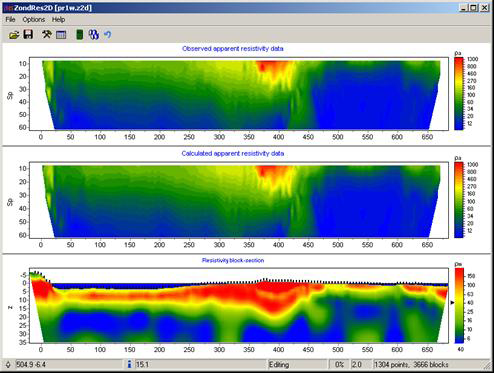
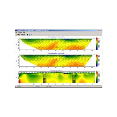
ZondRes2D is designed for 2D resistivity and IP, typical VES (DES), as well as electrotomography data interpretation. The program provides 2.5D modeling and data inversion. 2.5D means that geological structure is 2D, but the source field is 3D. Land, marine and borehole versions of the program are available. ZondRes2D includes VES, DES, electrotomography modeling, data processing and analysis, as well as data inversion. All possible variants of receiving and source electrode positions are used. Such approach improves reliability of inversion. ZondRes2D uses in own simple and simply to understand data format, but main known formats such as Res2Dinv, ABEM, Sens2dInv, etc. could be used as well.
Programs works with any of the main types of electric sounding array:
- 2 electrodes;
- 3 electrodes;
- 4 electrodes.
It is possible to use 3 coordinates (X, Y, Z) of each electrode.
Different kinds of inversion approaches are available.
There are convenient way to put apriori information.