ZondRes2d for Two-Dimensional Interpretation of Electrical Tomography Data Software
Zondres2d program is desined for two-dimensional interpretation of electrical tomography data by resistivity and induced polarization method in land, cross-borehole and marine cases. Electrical tomography is technique including both the method of field observations and technology of processing and field data interpretation. Its feature is multiple reusing as a source and receiver just the same electrodes position, fixed on a profile line.
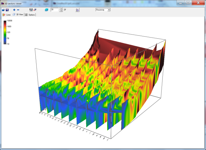
Such approach allows from one hand to work with a modern high-performance instruments, and on the other hand, to apply effective algorithms of modeling and inversion. For interpretation of electrical tomography data is used two- and three-dimensional models. It significantly extends the range of electric prospecting solved problems due to sections investigating that are considerably different from «classic» horizontal-layered.
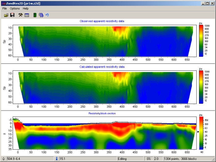
Resolution and thus interpretation quality of electrical tomography is closely connected with the number and density of measurements on the site. Their number usually reaches first thousand that is why the question of field measurements efficiency has basic importance and in many aspects defines possibility of practical using of this method. Special instruments with programmed automatic switching of electrodes is applied for reaching of maximum effectiveness of field works.
ZondRes2d represents ready solution for electrical tomography, and solves wide range of problems from mathematical modeling and sensitivity analysis to field data processing and interpretation. Convenient interface and variety of data visualization features allow to solve wide range of geological problems with maximum effectiveness.
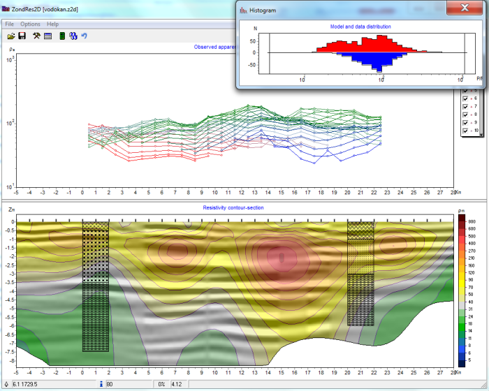
ZondRes2d uses simple and clear data format which allows easily combining various systems of observation, including different variants of the topography setting up and other additional information
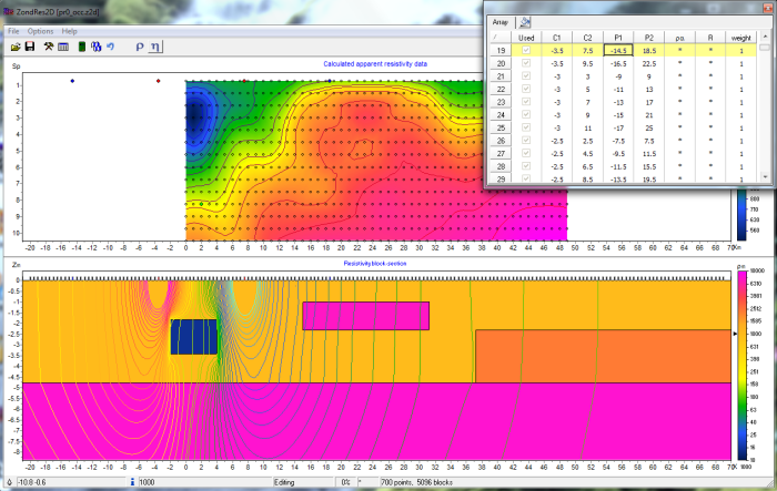
The program works with any (applied in electric prospecting) types of electrodes array (two, three and four – electrodes) or their combinations. It’s also support most popular formats Res2dInv, Syscal, Sens2dInv.
Important stage which prevents field measurement is mathematical modeling of geoelectric structure of work site. Modeling gives a chance to estimate the level of signal and to make a choice of optimum parameters of the observation system for decision of formulated geological problem. ZondRes2d has great range of tools for mathematical modeling and analysis of fields DC (direct current) sensitivity and induced polarization.
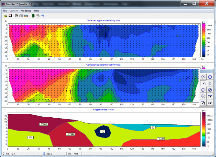
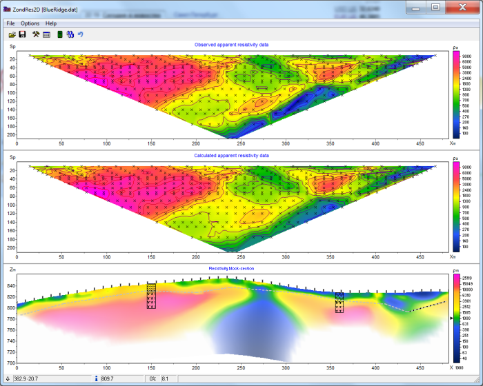
As the general task of the program is inversion of geoelectric parameters, some variants of inverse problem decision are realized in ZondRes2d, basic of them are: smoothing inversion – to get smooth model and focusing – to get piece-smoothed modelof geoelectric parameters with depth.
While program was designed special consideration given to a priori data accounting. Because of equivalence of inverse geophysical problems, quality of the obtained results strongly depends on the amount of a priori data used. In ZondRes2d there is possibility of weights setting for measurements, fixing and limits making of changing features of different cells, using of a priori model as reference in inversion. The robust schemas of noise estimation are realized in the software. There is also possibility to import and display results of measurements by other methods and cross-boreholes data that improved quality of results.