

GEM 401- Advanced GIS For Environmental Management
This course builds on GEM 400 and covers advanced topics in spatial analysis and data modeling using geographic information systems for environmental management. Students learn how to interpret remotely sensed data including multispectral satellite imagery and high resolution aerial photography to map and analyze land cover patterns, such as amount of forest interior available for wildlife, and how to create and analyze three-dimensional surfaces, visualize geospatial data, and understand point patterns and spatial autocorrelation.
This online course builds on GEM 400 and covers advanced topics in spatial analysis and data modeling using geographic information systems (GIS) for environmental management. The goal of this course is to provide a comprehensive introduction to the techniques and functions used in the analysis of spatial data. The analysis functions of GIS is to help in the understanding of the patterns and processes that lie beneath the features represented in the spatial database.
Students learn how to analyze spatial patterns, such as indicators of environmental risk, amount of forest interior available for wildlife, and how to create and analyze three-dimensional surfaces, visualize geospatial data, and understand point patterns and spatial autocorrelation. The course concludes with a discussion of GIS implementation and project management.
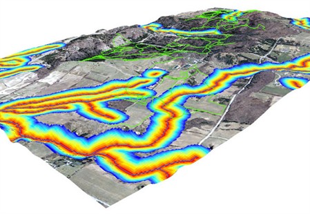
The course material uses few case studies. One case study is the Koffler Scientific Reserve at Joker`s Hill, a field research reserve owned by the University of Toronto that is the focus of a number of environmental research initiatives related to forest ecology and plant-animal interactions. Students use a variety of data, including aerial photographs, satellite imagery, and 3D elevation models to characterize the land cover and terrain of the reserve. In geostatistical excurses, spatial data for Vancouver Island, BC is used to analyze water acidity structure.
Following the same format as GEM400, the online course notes and the textbook explain the underlying theory, and how it is implemented in GIS software. The practical assignments then give students the opportunity to learn for themselves how to put that theory into practice, gaining hands-on experience with ESRI ArcInfo 10 software, the latest version of the most popular GIS and an industry standard in many fields, and the Spatial Analyst, 3D Analyst, and Geostatistical Analyst extensions.
This course is part of the Certificate in GIS for Environmental Management offered by the Centre for Environment (CFE) and can not be applied to any degree program at the University of Toronto.
The goal of the course is to provide students with the necessary understanding of advanced GIS concepts and theory, as well as practical skills, so that they are able to make informed decisions about how to approach a GIS-related problem and transfer their understanding to any GIS software. Upon successful completion of the course, students will understand how to work with geospatial data. Students will also understand the concept of autocorrelation and how to analyze point patterns. Emphasis is on gaining experience in raster geoprocessing as well as on making decisions about which geoprocessing tools are appropriate and in what order tools should be applied. The techniques of 3D terrain analysis are to visualize surfaces and explore possible relationships between land cover type and elevation, slope, and aspect are examined. Students will also understand the concept of spatial autocorrelation and point patterns analysis.