
Wetland Delineation Training (Classroom/Field)
The new Army Corps of Engineers Wetland Regional Supplements are published and many of them are being used for permit decisions. Even if you are an experienced wetland delineator, you need this class. Each Regional Supplement presents unique challenges that warrant training to fully understand. The Swamp School has developed a customized learning program for each of these regions. The classes are offered in local provinces based on socio-economic as well as ecological characteristics. Each province has unique features that include several wetland manuals. Most states require the use of more than one regional supplement.
1987 USACOE Wetlands Manual AND Regional Supplement Training
- Category: Wetland Delineation
- Level: 102
The Swamp School is committed to ensuring the health the safety of our students and faculty. All of our training facilities meet or exceed CDC COVID-19 guidelines.
Our class sizes have been reduced to meet the 6 foot distancing guideline. The 360 photo below is a virtual tour of our Angier, NC training location.
You can pan and zoom with your mouse to get a closer look.
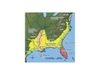
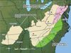
Regional Supplement Focus (choose from the following regions):
Location: Swamp School Wetland Training Center in 154 S Broad St. E Angier, NC 27501 (Raleigh, North Carolina)
- Eastern Mountains and Piedmont
- Atlantic and Gulf Coastal Plain
NEW: 2020 Navigable Waters Determination Procedures
The Swamp School’s method of teaching includes using all of the required regional supplements that are associated with the province. Students benefit by gaining an understanding of the subtle differences between the manuals. Geographic divides do not always represent the intricacies of the ecoregions identified in the various Regional Supplements. This class highlights where which manual should be used and why.
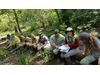
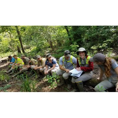
The training includes a 4-day field and classroom workshop. In the classroom, we will present the specific refinements to the 1987 Wetland Delineation Manual. Both manuals present changes to the analysis of soils, vegetation, and hydrology. The focus of the discussion will be to highlight the changes as well as discuss potential ramifications of adding new wetland indicators. Many of the public comments focused on the implication that sites might be called wetlands under the new Manuals that may not have been identified using just the 1987 Manual.
During the field portion of the class, we will complete several data points using the new Regional Supplement data forms. Sites have been selected to focus on the appropriate Regional Supplements and the local environmental conditions. On all sites, the 1987 Manual will also be utilized to compare and highlight any changes in the analysis. We will also identify strategies to present to the Corps if a site meets the Regional Supplement wetland criteria, but not the 1987 Manual criteria.
Point Intercept Method
Each student will receive as part of this class our all-new custom wetland densiometer. In addition, we will also include a custom automated vegetation inventory worksheet specifically designed to be used with the USACOE Point Intercept Sampling Method.
Materials Needed for Class:
You will need to provide the following items for this class:
- Munsell Soil Color Chart
- Soil auger or spade
- Local plant field guides
- Digital camera
Instructor:
These classes are taught by different instructors. They include Marc Seelinger, PWS. Marc has been teaching students to delineate wetlands since 1993. With over 25-years experience, Marc continues to help clients understand the technical and regulatory aspects of wetland rules. Marc shares his “real-world” expertise with students so that they may gain wisdom and technical know-how from his days of consulting. Marc’s clients have included government enterprises, engineering firms, energy companies, regulatory organizations, educational institutions, and real estate agencies.
PWS Pre-Approval:
This course has been pre-approved by the Society of Wetland Scientists Professional Certification Program (SWSPCP) as meeting standards for content and instruction and, upon successful completion, has been judged to be immediately eligible to receive credits and/or points toward SWSPCP Professional Certification or SWSPCP Professional.
Professional Development Hours: 36
Click here to learn more- https://swampschool.org/product/wetland-delineation-training/
At the end of this course, students should be able to.
- Distinguish key manuals and their usage in wetland determination
- Recognize important historical milestones in wetland delineation
- Know key case law which affects wetland delineation
- Pinpoint key agencies and their role in wetland determination
- Understand the nature of the classification of Waters of the United States
- Demonstrate knowledge of who can issue a Jurisdictional Determination and which agencies oversee the 404 program
- Identify hydrophytes and their use in wetland delineation
- Map plant communities and their respective data points
- Demonstrate basic competency in basic hydrology and recognition of key hydrology indicators
- Determine hydric soils and usage of Munsell Soil Chart
- Understand problem areas and local differences in wetland delineation
- Recognize atypical wetland areas and how to account for these in wetland delineation
- Use various data collected to write reports used for wetland determination by USACE
- Capture and understand offsite data usage in wetland delineation
- Distinguish between the two approaches of onsite wetland delineation
- Proper placement of flags demarking wetland areas
- Category: Wetland Delineation
- Level: 102
- Our Wetland Delineation Training includes a 4-day field and classroom workshop.