
Raymetrics S.A.
- Home
- Companies
- Raymetrics S.A.
- Applications
- Laser based remote sensing instruments ...
Laser based remote sensing instruments for numerical modeling applications - Environmental - Environmental Monitoring
FromRaymetrics S.A.
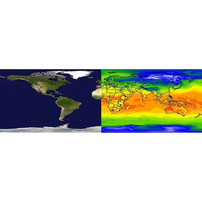
Raymetrics hosts its own modeling system, namely the RFS (Raymetrics integrated Forecasting System), which uses proprietary algorithms to integrate all available data streams and numerical models and provide optimal estimates of the atmospheric state .
Most popular related searches
laser remote sensing system
numerical modeling
laser remote sensing
weather forecasting software
remote sensing system
climate change
remote sensing
weather forecasting
environmental monitoring
environmental modeling
- Due to its modular nature RFS can be used in a great number of applications at various scales (synoptic to local) depending on customer needs
- Being an innovative tool in itself RFS can also be used to support scientific proposals and projects: Radiative impacts of natural/anthropogenic particles, air-sea interactions, health impacts, severe weather formation, climate change etc.. can all be studied using RFS
- RFS has been designed to be highly flexible and customizable, in order to meet all the demands of an ever-growing customer base
- Software developed in-house to visualize model outputs, depending on demands
- RFS outputs can be distributed in standardized formats (NetCDF, ascii, grib, grib2)
- The information can be integrated into any other weather forecasting software platforms
Stay in the loop!
Select your areas of interest to receive industry updates.