
SMART CITIES & MUNICIPALITIES - Government - Municipalities
Ortelium’s fully agnostic sensor interface allows you to create and manage your environmental data and turn it into urban informatics.
Do you want to create a dynamic noise map? Do you want to visualise and chart online-monitored PM 2.5 or PM 10 levels? Perhaps you later want to add NOx, SOx or other values? - No problem. Ortelium draws data from your weather stations, individual sensors, sensor grids, other web machines or your own business data pools.
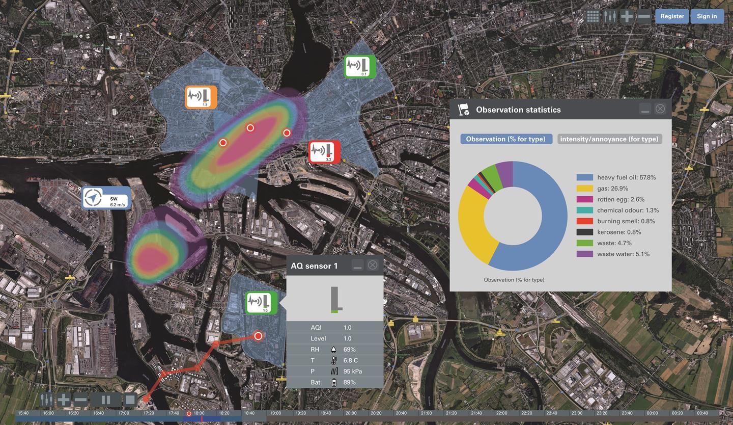
Combining observation results with process data
Monitor observations of citizens made via the Ortelium app to analyse the causes of frequently occurring nuisances, such as odour and noise. Combining observation results with process data from local industrial plants allows Smart Cities & Municipalities to locate the potential source of nuisances, making it possible to take measures to reduce the environmental impact from the respective source in intensity and frequency.
Instantly analyse the pathway
For air quality, odour and dust observations, Ortelium offers Smart Cities & Municipalities the option of integrating backtracking capabilities to instantly analyse the pathway of these observations, which is helpful especially in areas with a diversity of potential complaint sources, such as industrial parks and other industrial zones.
Update citizens directly
Through a ticketing system, Ortelium allows Smart Cities & Municipalities to update citizens directly on the status of their observations and the actions taken to develop a relationship of trust.