
- Home
- Companies
- Oizom Instruments Pvt. Ltd.
- Articles
- How Cities Use Air Quality Data for ...
How Cities Use Air Quality Data for Urban Planning
Urban planning increasingly treats air quality as an infrastructure input, leveraging multi-source data to reduce exposure, bolster resilience, and guide investment in healthier, more equitable cities.
Key data types and their value
- Pollutant concentration data: monitoring commonly tracked pollutants include PM2.5, PM10, NO2, O3, SO2, and CO. PM2.5 is particularly problematic due to its deep lung and systemic exposure.
- Temporal patterns: pollutants vary hourly and seasonally, with traffic-driven NO2 spikes during peak hours and winter inversions trapping pollutants near the ground; temporal data reveals peak exposure periods.
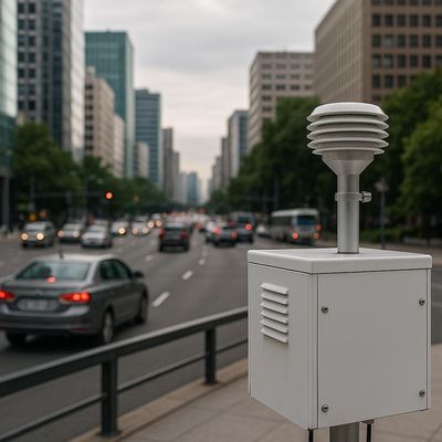
- Spatial distribution: hyperlocal mapping reveals pollution corridors along high-traffic routes, offering exposure data at neighborhood scales rather than citywide averages.
- Meteorological and dispersion data: wind and weather influence pollutant transport; understanding dispersion helps anticipate exposure for new developments.
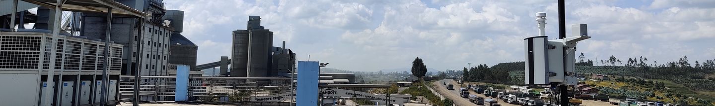
Data collection at scale
Cities rely on reference-grade monitoring stations for regulatory-grade measurements, complemented by networked sensors for hyperlocal data, mobile measurements for granularity, and satellite data for regional context. Cloud platforms consolidate these sources to enable real-time visualization, historical trend analysis, and multi-site comparison.
Identifying urban pollution hotspots
Hotspots commonly occur near major transport corridors and industrial zones. Chronic exposure reflects prolonged elevated PM2.5 levels, while acute exposure involves short-term peaks. Hotspots often overlap with vulnerable populations, including low-income and marginalized communities, highlighting inequitable burdens.
Air quality mapping supports targeted interventions, such as zoning modifications, traffic rerouting, and enhanced green buffers, to reduce exposure in high-risk areas.
Influence on planning decisions
Road networks and traffic planning: analysis of corridor pollution informs route design, emission-control strategies, low-emission zones, signal timing optimization, and expanded public transit to minimize exposure on key corridors.
Zoning and land-use planning: air quality maps inform buffer zones, residential placement relative to industrial areas, and the location of sensitive facilities such as schools and hospitals.
Green spaces and urban design: green infrastructure and ventilation corridors are used to mitigate pollution and improve microclimates, with data guiding the placement of trees, parks, and open spaces for maximum air-quality benefit.
Air quality in smart city and climate plans
Air quality monitoring feeds real-time dashboards within smart city ecosystems and informs capability to respond to exceedances. Integrating air quality with traffic systems, public advisories, and emergency protocols strengthens governance. In climate action planning, air quality and greenhouse gas reductions are assessed together to measure co-benefits of infrastructure investments, including electrification and emission controls.
As governance digitalization advances, air quality data supports operational intelligence and adaptive policy making.
From data to policy and action
- Establish emission standards and strengthen compliance.
- Regulate construction dust and manage pollution during high-pollution episodes.
- Implement traffic restrictions and modal shifts during severe events.
- Inform industrial permitting and monitoring.
- Provide public health advisories based on data-driven risk assessment.
Continuous air quality monitoring enables longitudinal policy evaluation and adaptive governance.
Characteristics of effective air-quality–driven urban planning
- Citywide, continuous monitoring networks
- Centralized data platforms with real-time visibility
- Cross-department collaboration among planning, transport, health, and environment agencies
- Predictive modeling capabilities
- Public transparency and reporting
These cities design infrastructure with air quality considerations at the core, transitioning from reactive mitigation to preventive planning.
Conclusion
Air quality is a measurable driver of urban system performance. Embedding atmospheric intelligence into long-range investment decisions improves health outcomes, productivity, climate resilience, and equity.
Original: https://oizom.com/how-cities-use-air-quality-data-for-urban-planning/