

Advanced Designs Corporation (ADC) software
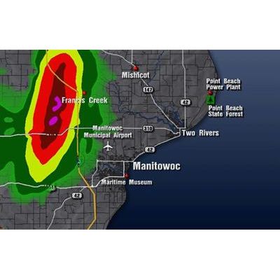
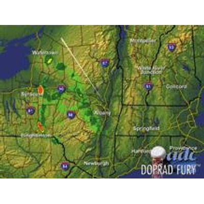
DOPRAD - Street-Level Mapping Software
Street-Level Mapping helps identify severe weather radar as it approaches specific locations such as schools, parks, airports, hospitals, or other locations of interest.
DOPRAD - Storm Path Analyzer Software-----------------
You can get the most out of your ADC Doppler Weather Radar by upgrading to our Storm Path Analyzer option.
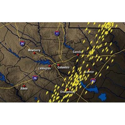
DOPRAD - Lightning Display Software
Can combine with Real-Time Radar (Displays lightning AND Doppler radar in realtime.). Can be used as a Stand Alone system (Lightning ONLY.). Real-Time strikes display within seconds of the actual occurrence. Displays multiple symbols. DOPRAD FURY: Direct lightning ingest from lightning vendor allows user-defined time periods to age or clear displayed strikes without the need for clearing radar data, also displays lightning polarity. Requires separate independent lightning data service contract with lightning vendor.

DOPRAD - Model I.E.P. - Illustrator Enhancement Package
This enhancement to our Street-Level Mapping and other software gives your weather department additional tools to help show viewers where severe weather is occurring with features like our built in illustrator and paste feature.
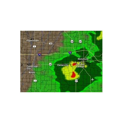
DOPRAD - Photo-Realistc Maps Software
Realistic Maps Upgrade for your DOPRAD FURY or DOPRAD LINUX.
DOPRAD FURY - Advanced Highest Resolution Weather Radar Display System
Upgrade your radar operations with the power of DOPRAD FURY!
DOPRAD - Mean Radial Velocity Software-------------
An option for the DOPRAD Radar System. You can get the most out of your ADC Doppler Weather Radar by upgrading to our Mean Radial Velocityoption. Mean Radial Velocity will open up a whole new world of severe weather indicators allowing your meteorologist and viewers to get a better handle on the true nature of storms. 15 levels of Doppler velocities in an independent mode : 7 levels of approaching velocities, 7 levels of receding velocities, and 1 cross-over velocity. Use 15 conventional shades of red and blue, or use your own user-defined color selection. In real-time, you can have the capability to display severe weather signatures.
DOPRAD - Model EZ-Street ID - Radar System
An option for the DOPRAD Radar System. The EZ-Street ID feature allows you the ability to quickly label roads/streets with a simple click of a mouse button.
DOPRAD - Model DEPIX - Radar System
An option for the DOPRAD Radar System. Our unique DEPIXelization processing reduces the `blocky` appearance that occurs when scaling radar returns down to a Street-Level Map. The process results in an ultra smooth and refined look that you will be proud to show your viewers.
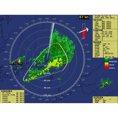
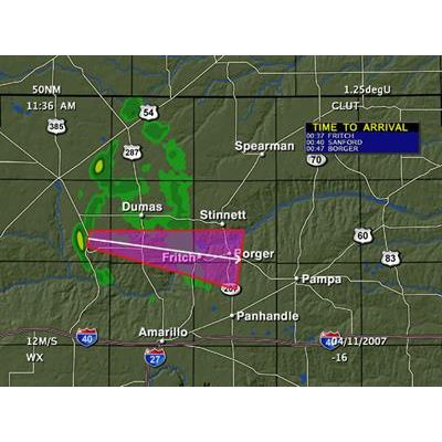
ADC STRAK - Automated Storm Tracking Software
To estimate an overall severe weather direction, speed, and confidence level. If the severe weather’s path will cross over the radar site, an ETA (Estimated Time of Arrival) will be generated co-located with the severe weather on the radar screen. The setup file (strak.dat) that controls the parameters of the STRAK feature can be found on the following page. The large white arrow indicates the direction of the storm. The storm speed is indicated above the arrow in yellow. The red indicator underneath the white arrow is the confidence level. The longer a storm stays on the same path, the red confidence indicator will go up. An ETA has been generated for one of the severe weather events because the projected path will cross the radar site.