

Bentham Geoconsulting Ltd services
Geophysical Survey Consultants and Contractor Services

Ground Penetrating Radar (GPR) Surveys
Ground Penetrating Radar, Ground Probing Radar, GPR, Impulse Radar and Surface Penetrating Radar are common names for the ground radar geophysical survey technique. It is a non-destructive geophysical survey method which can be used to obtain almost continuous subsurface geophysical data or obtain non-destructive testing data from a concrete or masonary structure.

Electrical Resistivity Imaging Geophysical Surveys
Electrical resistivity imaging geophysical surveys (also known as resistivity tomography, ERI or ERT) measure the resistivity properties of the sub-surface by assessing the potential drops between electrodes in a variety of configurations, depending upon the type of geophysical survey data required. Electrical resistivity surveys can be completed using a 4 electrode frame and the survey completed by walking the grid lines. The resulting data will give apparent electrical resisitivty data from a fixed depth range governed by the electrode spacing, usually 0.25 to 1m.
Electromagnetic (EM) Ground Conductivity Surveys
Electromagnetic surveys are a useful means by which to detect changes in the sub-surface relating to changes in electrical conductivity. Electromagnetic ground conductivity surveys are used for environmental and engineering investigations in order to map out sub-surface changes which can be investigated using traditional intrusive methods. The method is particularly useful for the delineation of a landfill boundarys, mapping in-situ faoundations or concrete slabs and when attempting to locate lost landfill.
Other
Instrumentation and Monitoring Solutions
You have a problem site or structure, you know the type of data you wish to collect but how can you maximise the data from that project? You don`t always want to send an engineer to site to download the data periodically. You want an alarm? We can help! Bentham Geoconsulting Limited are specialists in the installation of medium to long-term monitoring solutions. We can offer monitoring solutions that are truly remote. We call this service `structure to web` whereby data from on-site monitoring systems is made available for viewing via the web using a standard browser.
Noise and Vibration Monitoring Services
Noise and Vibration monitoring provides a means to assess your employees safety, the risk to adjacent properties and structures and to implement suitable abatement or preventative measures when compliance is required.Bentham Geoconsulting can provide a full service for measurement of noise and vibration. We provide an independent service including initial advice, attended on-site measurement and analysis followed by reporting.
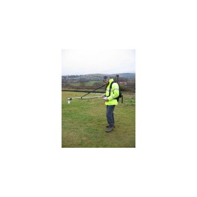
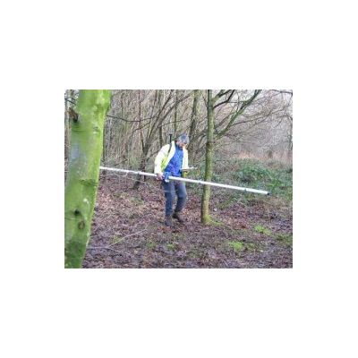
Magnetic Surveys using Magnetometer and Gradiometer Techniques
A magnetic geophysical survey comprising measurements of the local magnetic field using a magnetometer or gradiometer can detect variations of environmental, engineering and archaeological significance.