

Countryside Survey services
Field Survey Services
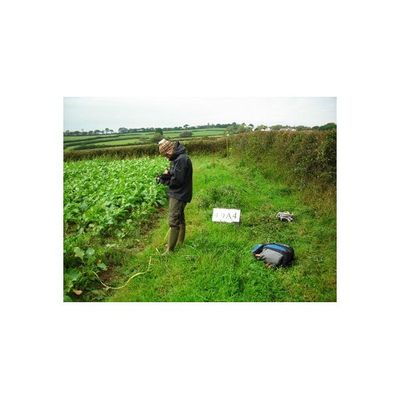
The Field Survey is a very detailed study of a sample of 1km squares, located all over England, Scotland and Wales. The individual squares are chosen so that they represent all major habitat types in the UK. Enough squares are selected for each type, to make sure that the statistical analysis for that habitat is robust and reliable. The location of the study squares is kept confidential to avoid any deliberate influences that could affect them or the features within them. In this way the sample squares will remain a true reflection of changes in the wider countryside; they will continue to provide a reliable comparison for future Surveys.
Land Cover Map Services
Land Cover Map 2015 (LCM2015) is the latest land cover map to be produced by the Centre for Ecology & Hydrology. It provides land cover information for the entire UK based on the Biodiversity Action Plan (BAP) Broad Habitats which are widely used in monitoring and reporting on our countryside. LCM2015 has been derived from satellite images, digital cartography, ground reference data and ancillary datasets.
Science and Research Services
Scientific teams (many from the Centre for Ecology and Hydrology) are using the results, data and analyses from Countryside Survey to investigate a range of interests relating to change in our natural resources. These interests are grouped into four main areas: determining whether a previously detected change in data or ‘signal’ has continued, the causes of changes, investigating how changes may affect ecosystem function and services, increasing our understanding of the processes of change, and our ability to forecast and manage change