

- Home
- Companies
- Countryside Survey
- Services
- Field Survey Services
Field Survey Services
The Field Survey is a very detailed study of a sample of 1km squares, located all over England, Scotland and Wales. The individual squares are chosen so that they represent all major habitat types in the UK. Enough squares are selected for each type, to make sure that the statistical analysis for that habitat is robust and reliable. The location of the study squares is kept confidential to avoid any deliberate influences that could affect them or the features within them. In this way the sample squares will remain a true reflection of changes in the wider countryside; they will continue to provide a reliable comparison for future Surveys.
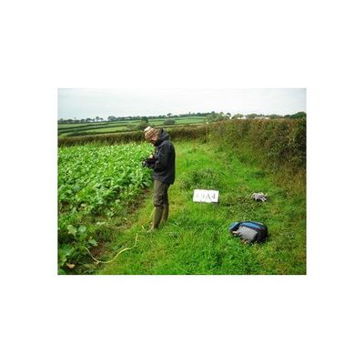
Within each 1km square, different features are recorded on a portable data recorder (similar to a very robust lap-top) using specially-developed software. Teams of trained field surveyors record a range of information, which includes:
- Mapping Broad and Priority habitats, as well as linear and point features
- Recording vegetation plots of different types (29 per square on average)
- Collecting measurements and samples from streams and ponds
- Collecting soil samples
- Taking geo-referenced photographs of plots to illustrate their settings
The 2007 field survey commenced in May and was completed in November.
More detail:The Field Survey Work Package was responsible for the overall collection of field data required for the 2007 Survey. Its main objective was to carry out the fieldwork for:
The responsibilities of the Field Survey Work Package included:- Recruiting and training field surveyors
- Coordinating survey teams on the ground
- Liaising with landowners
- Sourcing and maintaining existing and new equipment as required
- Producing the Countryside Survey ‘Field Handbook’ and developing field protocols (including issues of health and safety)
- Carrying out the field survey
- Ensuring all samples and data are delivered to other relevant Work Packages as soon after collection as possible
The surveying of over 591 1km squares across Great Britain requires a great deal of careful planning and management. The fieldwork itself was carried out by approximately 64 surveyors, divided into 16 teams of 4 people in each.
During the 2007 Survey, 289 squares were surveyed in England, 195 in Scotland and 107 in Wales. All of the surveyors underwent an intensive four-week training course to ensure the highest possible level of quality assurance. In addition, a small team from the Field Survey Work package was responsible for visiting the survey squares and repeating aspects of the survey as a quality assurance check (this alone involved a total of roughly 350 days on site).
Partners in Northern Ireland surveyed squares there in a complementary study. Four teams of field surveyors completed roughly 270 sample squares. Details of the Northern Ireland survey can be found on the Environment & Heritage Service Northern Ireland website.
What are the outputs of the Field Survey?Scientific data collected by the Field Survey Work Package comprises:- Vegetation data in electronic format (from repeat studies of plots surveyed in 1998/99; from new plots in arable field margins; and from plots in 60 new squares)
- Spatial data on Broad and Priority Habitats, as well as linear and point features, for all 591 squares of the Survey
- An aquatic macrophyte survey, a river habitats survey and various samples from the 425 squares surveyed by the Freshwaters Work Package in 1998
- Mapped locations of ponds in approximately 270 squares
- Pond survey data from one pond in each square
- Soil cores taken from each of the 5 ‘Main Plots’ surveyed by the Soils Work Package since 1978
- Veteran tree survey data for up to 10 trees per square