

- Home
- Companies
- Divestco Inc.
- Software
Divestco Inc. software
Software
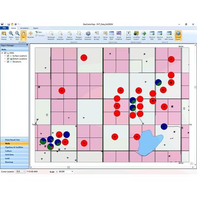
GeoCarta - Data Analysis & Mapping Software
Powerful mapping and analysis software fully integrated with well, land, LMR, log and midstream data. GeoCarta enables individuals and teams to make faster and more accurate decisions by easily exploring, analyzing, exporting and mapping public and proprietary well, log and land data.
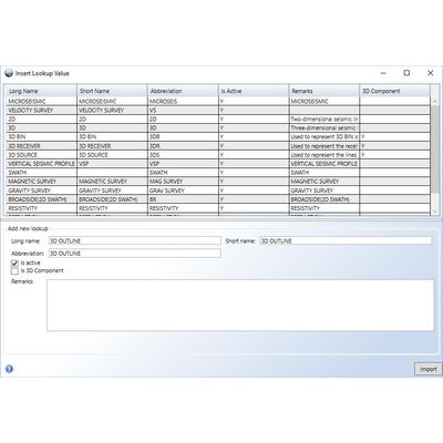
GeoCarta - Data Management Software
Managing your seismic metadata in a spreadsheet? Try GeoCarta for Data Management. Easy & powerful loaders combined with interactive spatial visualizations. One Tool for Public Data Searches & Proprietary Data Management. GeoCarta’s Data Management Module extends the GeoCarta platform for easily exploring, analyzing, exporting and mapping public and proprietary data to allow you to easily manage your own seismic meta-data.

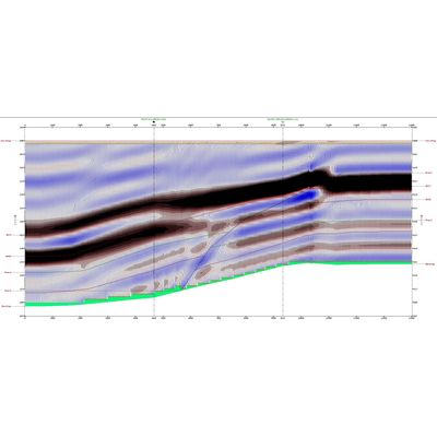
Glass - Model WinPICS - Seismic Interpretation Software
Powerful interpretation with an easy to learn user interface. Built from the science of our legacy products on a modern, stable and extensible platform. Designed from the ground-up with your exploration workflow in mind, Glass is a revolutionary advancement in Seismic Interpretation. Built on a foundation of tried and true science, Glass offers a stable platform with a modern user interface and compelling licensing options to maximize your exploration budget.
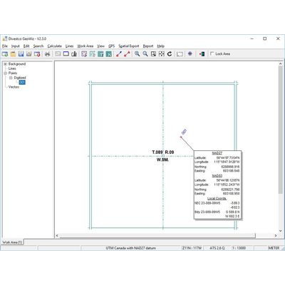
GeoWiz - Coordinate Conversion Software
Powerful coordinate conversion and directional well planning made easy. GeoWiz is a mapping application that enables you to translate field survey measurements into grid coordinates as well as perform localized project mapping, and seismic coordinate analysis. Use GeoWiz to quickly generate the essential information required by your office and field personnel, including seismic positional data, well site locations, and township and datum coordinate shifts.
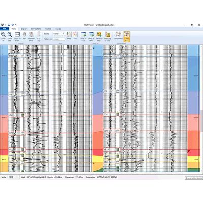
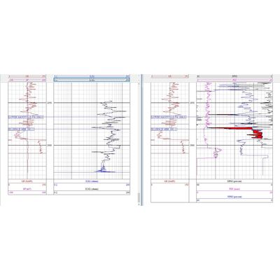
CrossLog - Log Cross Sections Suite
CrossLog Suite uses digital curves and scanned logs to enable you to quickly view, print, and interpret your scanned and digital well logs. CrossLog Suite retains maximum flexibility in drawing structural or stratigraphic cross sections without the need to set up maps or projects. The CrossLog Suite consists of three powerful tools to import, manage and create presentation-quality cross-sections.
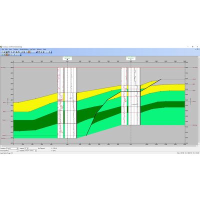
SynthSuite - Log Modeling Suite
Comprehensive and powerful stratigraphic log modeling. Divestco’s SynthSuite gives you unprecedented power when it comes to stratigraphic log modeling. SynthSuite consists of three integrated tools (InterpaLog, LogEdit and Synth1D) for fast, easy and precise modeling. Use InterpaLog to work with multi-well 2D modeling, use LogEdit to prepare and edit logs and use Synth1D to work with 1D seismograms.
Divestco - Exploration Bundle Software
All the exploration software and data you need for as low as $25K/year! Whether you’re starting a new exploration and production company, or simply looking to maximize value, Divestco’s Exploration Bundle provides all the software and data you need.
Divestco - Interpretive Workstation & Data Room Rentals Software
Divestco’s Seismic interpretive workstations rentals provide cost-effective, secure, seismic-interpretive workstations; outfitted with state-of-the-art equipment and Divestco software. As well, Divestco offers fully-supported, private Data Rooms, available for confidential third-party data viewing and seismic reviews.